Malanville
| Malanville | ||
|---|---|---|
|
|
||
| Coordinates | 11 ° 52 ′ N , 3 ° 22 ′ E | |
| Basic data | ||
| Country | Benin | |
| Alibori | ||
| ISO 3166-2 | BJ-AL | |
| surface | 3016 km² | |
| Residents | 44,608 (2012 estimate) | |
| density | 14.8 Ew. / km² | |
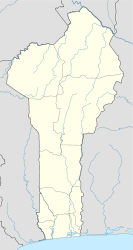
Malanville is a city in the north of the African state of Benin . The city is located in the Alibori department on the Niger River .
population
The population of Malanville is very mixed ethnically and religiously. Both Islamic and Christian beliefs are widespread in the city. The predominant languages in the city are French and local languages.
location
Malanville is located in the Dendi countryside on the banks of the Niger River on the border with neighboring Niger . The city is connected to the city of Gaya in the state of Niger by a bridge over the Niger . The Alibori flows about 15 km up the Niger and the Sota flows directly down the Niger .
market
The city is known for its lively market , which benefits from the border trade between Niger and Benin.
Web links
Commons : Malanville - collection of pictures, videos and audio files
Individual evidence
- ↑ WebCite query result. Retrieved September 27, 2017 (English).
- ↑ World Gazetteer: Malanville - profile of geographical entity includin… In: archive.is . January 5, 2013 ( archive.is [accessed September 27, 2017]).
- ↑ Olivier Walther: Sons of the Soil and Conquerors Who Came on Foot: The Historical Evolution of a West African Border Region . In: African Studies Quarterly . Vol. 13, No. 1 & 2 , 2012, p. 77 ( sites.clas.ufl.edu [PDF; accessed November 4, 2018]).
- ↑ Malanville. Retrieved September 27, 2017 (English).

