Malta plateau
| Malta plateau | ||
|---|---|---|
| Highest peak | Mount Phillips ( 3035 m ) | |
| location | Victoria Land , East Antarctica | |
| part of | Victory Mountains , Transantarctic Mountains | |
|
|
||
| Coordinates | 72 ° 58 ′ S , 167 ° 18 ′ E | |
|
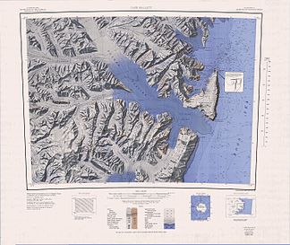
Map from 1968 showing the Malta Plateau in the southwest |
||
|
Map from 1967 showing the southern part of the Malta Plateau in the northwest |
||
The Malta Plateau is an icy high plateau about 40 km in extent in the Victory Mountains of the East Antarctic Victoria Land . The irregularly shaped plateau is bounded in the south and west by the Mariner glacier , in the north by secondary glaciers of the Trafalgar glacier and in the east by secondary glaciers of the Borchgrevink glacier .
The New Zealand Antarctic Place-Names Committee named it to remember the importance of the island of Malta in connection with the naming background for the Victory Mountains.
Web links
- Malta plateau in the Geographic Names Information System of the United States Geological Survey (English)
- Malta Plateau on geographic.org (English)


