Victory Mountains
| Victory Mountains | ||
|---|---|---|
| Highest peak | Mount Riddolls ( 3295 m ) | |
| location | Victoria Land , East Antarctica | |
| part of | Transantarctic Mountains | |
|
|
||
| Coordinates | 72 ° 40 ′ S , 168 ° 0 ′ E | |
|
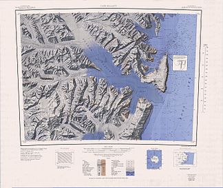
1968 map of the Victory Mountains and Admiralty Mountains |
||
The Victory Mountains are a group of mountains stretching 160 km in length and 80 km in width on the east coast of East Antarctica, Victoria Land , and are comprised primarily of the Polar Plateau , the Mariner Glacier , the Tucker Glacier , the Whitehall Glaciers and the Ross Sea . The boundary between these mountains and the northwestern Concord Mountains , on the other hand, can be determined less precisely, but is roughly not far from Thomson Peak . The highest peaks are Mount Riddolls ( 3295 m ), Mount Hancox ( 3245 m ), Mount Phillips ( 3035 m ), Mount Burton ( 2740 m ), Gless Peak ( 2630 m ), Mount Alberts ( 2320 m ) and Mount Brewster ( 2025 m ).
The section of the Victory Mountains that can be seen from the Ross Sea was recorded during the expeditions of James Clark Ross , Carsten Egeberg Borchgrevinks , Ernest Shackletons and Robert Falcon Scott . The inner part of the mountain range was mapped mainly using aerial photographs by the United States Navy and with the help of survey work by US and New Zealand crews in the 1950s and 1960s. Participants of the New Zealand Geological Survey Antarctic Expedition (1957-1958) named them based on the naming of the nearby Admiralty Mountains in view of the victorious Royal Navy (English victory = victory).
Web links
- Victory Mountains in the Geographic Names Information System of the United States Geological Survey (English)
- Victory Mountains on geographic.org (English).

