Admiralty Mountains
| Admiralty Mountains | ||
|---|---|---|
|
The Mount Herschel (3,335 m) in the Admiralty Mountains as the Cape Hallett is seen from |
||
| Highest peak | Mount Minto ( 4165 m ) | |
| location | Victorialand , East Antarctica | |
| part of | Transantarctic Mountains | |
|
|
||
| Coordinates | 71 ° 45 ′ S , 168 ° 30 ′ E | |
|
ADMIRALTY MOUNTAINS on the map sheet |
||
|
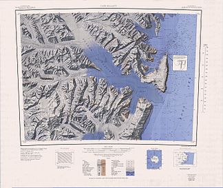
Map sheet Cape Hallett from 1968 with the southern part of the Admiralty Mountains in the northeast of the map |
||
The Admiralty Mountains ( English Admiralty Mountains or Admiralty Range ) are a broad group of high mountains and individually named mountain ranges and backing in the northeastern Victoria Land in the Antarctic . The mountain group is bounded by the Ross Sea , the Southern Ocean and the Dennistoun , Ebbe and Tucker Glaciers .
The mountains were discovered in January 1841 by Captain James Clark Ross , who named it after the Admiralty under whose command he sailed.
The mountains include the following mountains and peaks:
| mountain | meter |
|---|---|
| Mount Minto | 4165 |
| Mount Adam | 4010 |
| Mount Ajax | 3770 |
| Mount Royalist | 3640 |
| Mount Black Prince | 3405 |
| Mount Herschel | 3335 |
| Mount Peacock | 3215 |
| Sorensen Peak | 2640 |
| Grigg Peak | 2130 |
| Mount Parker | 1260 |
See also


