
Manantenina
Coordinates: 24 ° 17 ′ S , 47 ° 19 ′ E

Manantenina is a place in southeast Madagascar and the seat of the rural community of the same name ( Commune rural ). The place is located in the Anosy region , about 120 km north of the city of Tolagnaro in the immediate vicinity of the coast.
Geography and vegetation
The place is located on the south bank of the Manampanihy River at 21 meters above sea level and about 3 kilometers west of the coast of the Indian Ocean . The coastal fringe, which is only a few kilometers wide and shaped by dunes, contains a rich flora with pitcher plants . Further inland, the terrain gradually rises to the west to 60–80 meters and forms an 8 to 14 km wide area that was originally made up of forest. Today the forest has almost completely disappeared due to illegal slash and burn, in its place a savannah with ravenala and various types of grass has been replaced.
Population and economy
Most of the population belongs to the Antanosy tribe ( Foko ) . The last census in 2001 counted 18,905 inhabitants, the annual population growth is 2.9%. The main industries are fishing (50%), agriculture (35%) and cattle breeding (10%). The main crops are cassava , rice and sweet potatoes . During the first decade of the 21st century, the town and the surrounding villages were hit several times by cyclones and bad harvests, which led to acute malnutrition among the population.
Infrastructure
The place is connected to the capital of the Tolagnaro region by the unpaved national road 12a . There is a post office, a simply equipped hospital ( Center de Santé de Base II ) as well as a secondary and several primary schools.
bauxite
In 1961 , the Geological Service of Madagascar ( Service Géologique ) discovered bauxite in the area of the municipality . This bauxite deposit is developed on a leveling area 25 to 60 meters above sea level, the subsurface of which is formed by aluminum-rich gneisses . Extensive drilling work was carried out in the early 1970s; up to 1973 165 million tons of ore could be detected. After the deposit had remained unnoticed by international aluminum producers for several decades, Rio Tinto Alcan signed an agreement in late 2006 with a Malagasy company to jointly mine the ore and build an aluminum refinery .
Picture gallery
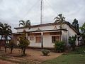
Post office in Manantenina
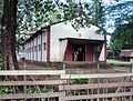
Catholic Church
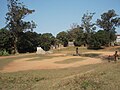
Central meeting place with a memorial stone for independence in 1960

Memorial to the fallen of both world wars

View along the main street

Bauxite deposits in the center of the village


Individual evidence
- ↑ Carte de Madagascar au 1 / 100,000. Feuille OP.60 Manantenina. Service Géographique, Tananarive, 1961
- ↑ Map of deforestation in the Anosy region ( page no longer available , search in web archives ) Info: The link was automatically marked as defective. Please check the link according to the instructions and then remove this notice.
- ↑ ILO census data . Cornell University . 2002. Retrieved December 29, 2010.
- ^ Report on a CARE aid project , accessed on December 29, 2010
- ↑ Gabriel Hottin: Bauxite de Manantenina . Report annuel de Service Géologique. Antananarivo 1961, pp. 107-112.
- ↑ Brief description of the deposit , accessed on December 29, 2010
- ↑ USGS Minerals Yearbook 2008 (English; PDF; 285 kB), p. 26.1, accessed on December 29, 2010
Web links
- Map of the municipality with infrastructure facilities , accessed on December 29, 2010.