Mar Dyke
| Mar Dyke | ||
|
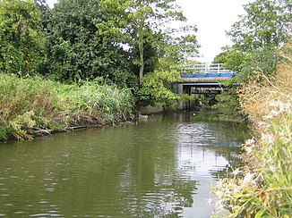
The Mar Dyke at Purfleet |
||
| Data | ||
| location | Essex , England | |
| River system | Thames | |
| Drain over | Thames → North Sea | |
| source | two arms in Thurrock | |
| muzzle | in the Thames Coordinates: 51 ° 29 ′ 9 ″ N , 0 ° 13 ′ 40 ″ E 51 ° 29 ′ 9 ″ N , 0 ° 13 ′ 40 ″ E
|
|
The Mar Dyke is a watercourse in Thurrock , Essex , England . The Mar Dyke formed ( 51 ° 32 '24 " N , 0 ° 19' 53" O ) of two main arms, a northern ( 51 ° 33 '24 " N , 0 ° 19' 7" O ) and an east ( 51 ° 33 ′ 12 ″ N , 0 ° 20 ′ 50 ″ E ), which in turn arise from numerous small tributaries. Numerous small tributaries also feed the common run.
The Mar Dyke initially flows south and turns southeast of South Ockendon in a westerly direction to flow into the Thames at Purfleet .
