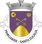
Margaride
| Margaride | ||||||
|---|---|---|---|---|---|---|
|
||||||
| Basic data | ||||||
| Region : | Norte | |||||
| Sub-region : | Tâmega e Sousa | |||||
| District : | postage | |||||
| Concelho : | Felgueiras | |||||
| Freguesia : | União das Freguesias de Margaride (Santa Eulália), Várzea, Lagares, Varziela e Moure | |||||
| Coordinates : | 41 ° 22 ′ N , 8 ° 12 ′ W | |||||
Margaride is a place and a former municipality ( Freguesia ) in the Portuguese district of Felgueiras . The community had 9,666 inhabitants (as of June 30, 2011).
On September 29, 2013, the municipalities of Margaride (Santa Eulália), Várzea , Lagares , Varziela and Moure were merged to form the new municipality of União das Freguesias de Margaride (Santa Eulália), Várzea, Lagares, Varziela e Moure . Margaride (Santa Eulália) is the seat of this newly formed municipality.
Individual evidence
- ↑ www.ine.pt - indicator resident population by place of residence and sex; Decennial in the database of the Instituto Nacional de Estatística
- ^ Publication of the administrative reorganization in the Diário da República gazette of January 28, 2013, accessed on October 1, 2014

