Marshall Bay
| Marshall Bay | ||
|---|---|---|
|
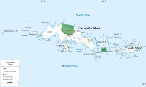
Map of Coronation Island (center) with Marshall Bay |
||
| Waters | Normanna Strait | |
| Land mass | Coronation Island , South Orkney Islands | |
| Geographical location | 60 ° 39 ′ 0 ″ S , 45 ° 37 ′ 59 ″ W | |
|
|
||
| width | 3 km | |
The Marshall Bay is a 3-km wide bay on the south coast of Coronation Iceland in Archipelago of the South Orkney Islands . It lies between Cape Hansen and Cape Vik .
The Norwegian whaling captain Petter Sørlle (1884-1933) made a rough map of the bay between 1912 and 1913. Participants in the British Discovery Investigations specified this in 1933. The name is given by the British surgeon and bacteriologist Edward Hillis Marshall (1885–1975), a member of the Executive Committee of the Discovery Investigations.
Web links
- Marshall Bay in the Geographic Names Information System of the United States Geological Survey (English)
- Marshall Bay on geographic.org (English)

