McKinley Peak
| McKinley Peak | ||
|---|---|---|
| height | 883 m | |
| location | Marie Byrd Land , West Antarctica | |
| Mountains | Ford Ranges | |
| Coordinates | 77 ° 54 ′ 0 ″ S , 148 ° 18 ′ 0 ″ W | |
|
|
||
|
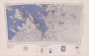
McKinley Peak topographic map (bottom left) |
||
The McKinley Peak is a 883 m high mountain in the West Antarctic Marie Byrd Land . It rises 15 miles west of Hershey Ridge at the southern end of the Ford Ranges .
Participants of the first Antarctic expedition (1928-1930) of the American polar explorer Richard Evelyn Byrd discovered him during an overflight on December 5, 1929. Byrd named the mountain after the wife of Ashley Chadbourne McKinley (1896-1970), who worked as an aerial photographer and as second deputy head was active on this research trip.
Web links
- McKinley Peak in the Geographic Names Information System of the United States Geological Survey (English)
- McKinley Peak on geographic.org (English)

