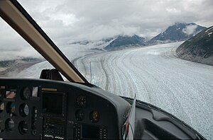
Meade Glacier
| Meade Glacier | ||
|---|---|---|
|
Meade Glacier (right) unites with a secondary glacier almost 11 km above the lower end of the glacier |
||
| location | Alaska (USA) | |
| Mountains | Boundary Ranges ( Coast Mountains ) | |
| Type | Valley glacier | |
| length | 30 km | |
| Exposure | west | |
| Altitude range | 1500 m - 150 m | |
| width | ⌀ 1.8 km | |
| Coordinates | 59 ° 13 ′ N , 134 ° 59 ′ W | |
|
|
||
| drainage | Katzehin River → Chilkoot Inlet ( Pacific Ocean ) | |
| particularities | Glacier edge lake | |
The Meade Glacier is a 30 km long valley and outlet glacier in the Tongass National Forest in the Boundary Ranges in Alaska (USA).
geography
The glacier tongue of Meade Glacier is located 25 km east of Haines in Southeast Alaska . The glacier drains part of the Juneau Icefield . It has several tributary glaciers , some of which are on the Canadian side of the border. The nutrient area of the Meade Glacier is located 8 km west of the border summit Mount Poletica ( Boundary Peak 102 ) at an altitude of about 1500 m . From there it flows in a north-northwest direction. Almost 11 km above the lower end of the glacier, the Meade Glacier joins a large, nameless secondary glacier coming from the right. In doing so, it changes its direction to the southwest. Finally he turns west on his last stretch. A lake at the edge of the glacier is located below the glacier tongue, which is about 150 m above sea level . The lake is drained by the 22 km long Katzehin River to the Chilkoot Inlet . The mean width of the glacier is around 1.8 km.

