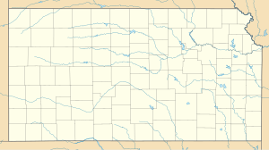
Melvern Lake
| Melvern Lake | |||||||||
|---|---|---|---|---|---|---|---|---|---|
| Melvern Lake | |||||||||
|
|||||||||
|
|
|||||||||
| Coordinates | 38 ° 29 '23 " N , 95 ° 47' 57" W | ||||||||
| Data on the structure | |||||||||
| Lock type: | Earthfill dam with a clay core | ||||||||
| Construction time: | 1967-1972 | ||||||||
| Height above valley floor: | 35.9 m | ||||||||
| Crown length: | 2 941 m | ||||||||
| Operator: | US Army Corps of Engineers, Kansas City District | ||||||||
| Data on the reservoir | |||||||||
| Altitude (at congestion destination ) | 316 m | ||||||||
| Water surface | 56.454 km² | ||||||||
| Maximum depth | 22.6 m | ||||||||
| Catchment area | 904 km² | ||||||||
The Melvern Lake is a reservoir in the State of Kansas .
geography
The lake is located in Osage County south of the city of Osage City . It dams the Marais of the Cygnes River by means of a 3 km long dam of the US Army Corps of Engineers .
Others
The recreational areas Eisenhower State Park and Turkey Point are located on the lake .
Web links
- Melvern Lake in the United States Geological Survey's Geographic Names Information System
- Melvern Lake at the US Army Corps of Engineers, Kansas City District
Individual evidence
- ↑ Melvern Lake, Kansas (PDF, 2.4 MB) US Army Corps of Engineers, Kansas City District. Retrieved December 8, 2017.

