Miel I (hydropower plant)
| Patángoras dam, Miel I hydropower plant, Amaní reservoir | |||||||||
|---|---|---|---|---|---|---|---|---|---|
| Miel I. | |||||||||
|
|||||||||
|
|
|||||||||
| Coordinates | 5 ° 33 '38 " N , 74 ° 53' 12" W | ||||||||
| Data on the structure | |||||||||
| Lock type: | Rolled concrete dam wall | ||||||||
| Construction time: | 1997-2003 | ||||||||
| Height of the barrier structure : | 188 m | ||||||||
| Height above foundation level : | 200 m (?) | ||||||||
| Height of the structure crown: | 454 m | ||||||||
| Building volume: | 1.75 million m³ | ||||||||
| Crown length: | 340 m | ||||||||
| Power plant output: | 375 MW | ||||||||
| Operator: | ISAGEN | ||||||||
| Data on the reservoir | |||||||||
| Altitude (at congestion destination ) | 445.5 m | ||||||||
| Water surface | 12.2 km² | ||||||||
| Reservoir length | 22 km | ||||||||
| Reservoir width | 500 m | ||||||||
| Storage space | 565 million m³ | ||||||||
| Catchment area | 770 km² | ||||||||
| Design flood : | 1 720 m³ / s | ||||||||
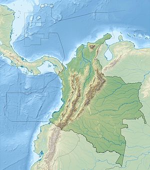
The Patángoras Dam is located on the Río La Miel , a left tributary of the Río Magdalena , in the Central Cordillera of Colombia . The dam is located in the Departamento de Caldas , 125 km northwest of Bogotá .
Patángoras dam
The Patángoras Dam (Spanish: Presa Patángoras ) is 188 meters high and is currently the tallest dam in rolled concrete or RCC construction ( RCC = roller compacted concrete ). The dam was completed in 2002, surpassing the previous record of 136 m in height.
The dam is part of a hydropower project in the municipality of Norcasia in the department of Caldas . The dam was built between December 1997 and December 2002. The rolled concrete with a volume of 1.75 million cubic meters was poured within 25 months.
La Miel I hydropower plant
The water is fed to the underground La Miel I (Spanish Central Hidroeléctrica Miel I ) power station on the northern side of the dam . The cavern power plant consists of three units, each with a Francis turbine with an output of 125 MW. The substation ( ⊙ ) is 400 m north of the dam. The expansion water volume is 84 m³ / s. The average annual energy production was initially 1460 GWh. The addition of water from the Río Guarinó and Río Manso increased the annual energy production to 2012 GWh. The water returns to the river via a 4.1 km long underground drainage channel ( ⊙ ).
Amani reservoir
The Río La Miel is dammed by the dam over a length of 22 km to the Amaní reservoir (Spanish: Embalse Amaní ). The Río Moro is dammed over a length of 14 km. The maximum sea width is around 500 m. The reservoir covers an area of 12.2 km². The target is 445.5 m . The storage space is 565 million m³.
![]() Map with all coordinates: OSM | WikiMap
Map with all coordinates: OSM | WikiMap
See also
- List of the largest dams on earth
- List of the largest reservoirs on earth
- List of the largest hydroelectric plants in the world
- List of power plants in Colombia
- List of dams in the world (Colombia)
Web links
- MIEL I - RCC record breaker
- Miel I.
- High times at Miel I RCC dam
- 1.4 CENTRAL HIDROELÉCTRICA MIEL I at bdigital.unal.edu.co (PDF, 3.2 MB)

