Mount Aurora
| Mount Aurora | ||
|---|---|---|
|
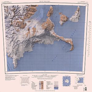
Map sheet with Mount Aurora (1041 m) on Black Island in the northeast |
||
| height | 1041 m | |
| location | Black Island , Ross Archipelago , Antarctica | |
| Coordinates | 78 ° 14 ′ 0 ″ S , 166 ° 21 ′ 0 ″ E | |
|
|
||
| Type | Stratovolcano | |
| Normal way | Alpine tour (glaciated) | |
Mount Aurora is a round volcanic cone and with a height of 1041 m it is the highest mountain on Black Island in the Antarctic Ross Archipelago .
Participants of the New Zealand Geological Survey Antarctic Expedition (1958-1959) named him after the Aurora , the ship of the Ross Sea Party as part of the endurance expedition (1914-1917) of the British polar explorer Ernest Shackleton .
Web links
- Mount Aurora in the Geographic Names Information System of the United States Geological Survey (English)
- Mount Aurora on geographic.org (English)

