Mount Baker Wilderness
|
Mount Baker Wilderness
|
||
|
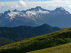
Twin Sisters Mountain from Grouse Ridge from |
||
| location | Whatcom County , Washington , USA | |
| surface | 485.58 km² | |
| WDPA ID | 372142 | |
| Geographical location | 48 ° 48 ′ N , 121 ° 45 ′ W | |
|
|
||
| Setup date | 1984 | |
| administration | US Forest Service | |
The Mount Baker Wilderness is an approximately 485 square kilometers large wilderness area within the Mount Baker-Snoqualmie National Forest in the western Cascade Mountains in the northern US state of Washington . Its eastern limit is 40 miles away with the western limit of the Stephen Mather Wilderness and the North Cascades National Park . The wilderness area extends north from Washington State Route 20 to the border between Canada and the United States . To the west it is bounded by the foothills of the Cascade Range in transition to the lowlands on Puget Sound . The closest town is Bellingham .
Entirely located in Whatcom County , the wilderness area extends on the western slopes of the Cascade Range. The three arms of the Nooksack River and the Baker River are the main drains.
ecology
The vegetation is typical of the western slopes of the Cascade Mountains and includes, among other things, giant arborvitae , coastal Douglas firs , noble firs , purple firs , rocky mountain firs , western American hemlocks and mountain hemlocks and, at higher altitudes, alpine mats . Mountain goats and ice-gray marmots can be found on animals .
geology
![]() Map with all coordinates of the geology section : OSM
Map with all coordinates of the geology section : OSM
On the mountains and higher ridges, significant areas of rock and permanent glaciers extend over forty square kilometers.
The terrain is rugged with steep slopes and a multitude of mountain ridges divided by permanent or temporary drains. Mount Baker (10,420 ft (3,176 m) - 48 ° 47 ′ N , 121 ° 49 ′ W ), an active volcano, is one of the area's most prominent features. The mountain shows periodic thermal activity. As the northernmost volcano in Washington, it reaches 3,285 meters. Other high mountains are:
- Twin Sisters Mountain , North Twin (6,650 ft (2,027 m)) - 48 ° 43 ′ N , 122 ° 0 ′ W
- Twin Sisters Mountain, South Twin (6,965 ft (2,123 m)) - 48 ° 42 ′ N , 121 ° 59 ′ W
- Tomyhoi Peak (7,293 ft (2,223 m)) - 48 ° 58 ′ N , 121 ° 43 ′ W.
- American Border Peak (7,992 ft (2,436 m)) - 49 ° 0 ′ N , 121 ° 40 ′ W.
- Mount Larrabee (formerly Red Mountain ) (7,821 ft (2,384 m)) - 48 ° 59 ′ N , 121 ° 39 ′ W
- Goat Mountain (6,811 ft (2,076 m)) - 48 ° 55 ′ N , 121 ° 35 ′ W.
- Mount Sefrit (7,165 ft (2,184 m)) - 48 ° 53 ′ N , 121 ° 36 ′ W.
- Ruth Mountain (7,103 ft (2,165 m)) - 48 ° 52 ′ N , 121 ° 32 ′ W.
- Hadley Peak (7,470 ft (2,277 m)) - 48 ° 49 ′ N , 121 ° 49 ′ W.
The wilderness area is entirely within the Mount Baker-Snoqualmie National Forest and adjacent to the Mount Baker National Recreation Area .
See also
Individual evidence
- ↑ a b Mount Baker Wilderness . University of Montana. Retrieved March 16, 2015.
- ↑ a b Mt.Baker Wilderness . US Forest Service. Retrieved March 16, 2015.
- ↑ Mount Baker ( English ) In: Geographic Names Information System . United States Geological Survey . Retrieved June 19, 2018.
- ↑ North Twin ( English ) In: Geographic Names Information System . United States Geological Survey . Retrieved June 19, 2018.
- ^ South Twin ( English ) In: Geographic Names Information System . United States Geological Survey . Retrieved June 19, 2018.
- ↑ Tomyhoi Peak ( English ) In: Geographic Names Information System . United States Geological Survey . Retrieved June 19, 2018.
- ↑ American Border Peak ( English ) In: Geographic Names Information System . United States Geological Survey . Retrieved June 19, 2018.
- ↑ Mount Larrabee ( English ) In: Geographic Names Information System . United States Geological Survey . Retrieved June 19, 2018.
- ^ Goat Mountain Trail, Whatcom County, Washington, United States of America . OpenStreetMap.org. Retrieved June 19, 2018.
- ↑ Mount Sefrit ( English ) In: Geographic Names Information System . United States Geological Survey . Retrieved June 19, 2018.
- ↑ Ruth Mountain ( English ) In: Geographic Names Information System . United States Geological Survey . Retrieved June 19, 2018.
- ↑ Hadley Peak ( English ) In: Geographic Names Information System . United States Geological Survey . Retrieved June 19, 2018.
Web links
- Mt.Baker Wilderness US Forest Service (English)
- Mount Baker Wilderness The University of Montana (adapted PD source - English)


