Twin Sisters Mountain
| Twin Sisters Mountain | ||
|---|---|---|
|
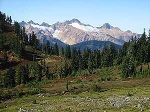
View from the south flank of Mount Baker towards Twin Sisters Mountain |
||
| height | 2130 m | |
| location | Whatcom County , Washington , USA | |
| Mountains | Cascade chain | |
| Notch height | 1070 m | |
| Coordinates | 48 ° 42 ′ 16 ″ N , 121 ° 59 ′ 15 ″ W | |
|
|
||
| rock | igneous dunite | |
The Twin Sisters Mountain ( Nooksack : Kwetl'kwítl 'Smánit , "red mountain"), commonly called the Twin Sisters , is a mountain in Whatcom County in the US state of Washington . As part of the Cascade Range, it lies just southwest of Mount Baker . Of the two peaks is the South Twin higher with a height of 7,004 ft (2,135 m). The summit of the North Twin is above 6,644 ft (2,025 m). There are several glaciers on the northeast slope of Twin Sisters Mountain.
geography
Both peaks are within the Mount Baker Wilderness . Twin Sisters Mountain as a whole is located southwest of Mount Baker, separated from the volcano by the Middle Fork Nooksack River . The South Fork Nooksack River flows around the east end of Twin Sisters Mountain. Other streams that drain Twin Sisters Mountain are Skookum Creek, Sister Creek, Green Creek, and Howard Creek. All of these streams ultimately flow into the Nooksack River.
geology
The Twin Sisters Mountain consists of relatively unchanged dunite , an ultramafic rock that contains mainly olivine . The Twin Sisters Range ("range" = "mountain chain") is a massive clod of relatively dense rock that was lifted up as a tectonic blanket by a thrust . The magnesium- and iron-rich rock was driven upwards in the Mesozoic by a tectonic movement between the Bell Pass Mélange and the Chilliwack River Terran . The reddish color in the chain could come from the oxidation of the iron and magnesium in dunite, which is exposed to chemical weathering . Petrologically , the Twin Sisters dunite consists of enstatite- rich rock, which - apart from olivine - has significant proportions of chromite , pyroxene and serpentinite . These minerals are usually associated with ultra-amphic rocks that crystallize below the earth's crust in the earth's mantle . The serpentinized minerals are believed to have been formed during later phases of uplift, when water penetrated through the crevices in the tectonic blanket and triggered a metamorphosis .
Individual evidence
- ↑ a b South Twin, Washington . PeakBagger.com 1 . Retrieved June 19, 2018.
- ^ Cultural Resources Department . In: NookSack Indian Tribe . Retrieved September 16, 2013.
- ↑ North Twin, Washington . PeakBagger.com 2 . Retrieved June 19, 2018.
- ^ Washington Road & Recreation Atlas . Benchmark Maps, 2000.
- ↑ Generalized Geological Map of the Mount Baker 1: 100,000 Quadrangle . In: North Cascades geological map . USGS. Retrieved July 16, 2007.
- ↑ Donal M. Ragan: Emplacement of the Twin Sisters Dunite . In: American Journal of Science . 261, No. 6, 1963, pp. 549-565. doi : 10.2475 / ajs.261.6.549 . Retrieved October 9, 2013.
- ^ Rocks of the Western Domain . In: USGS Geology in the Parks . USGS. Archived from the original on July 16, 2007. Info: The archive link was inserted automatically and has not yet been checked. Please check the original and archive link according to the instructions and then remove this notice. Retrieved July 16, 2007.
Remarks
Web links
- Twin Sisters Mountain ( English ) In: Geographic Names Information System . United States Geological Survey .
- South Twin ( English ) In: Geographic Names Information System . United States Geological Survey .
- North Twin ( English ) In: Geographic Names Information System . United States Geological Survey .

