Mount Scott
| Mount Scott | ||
|---|---|---|
|
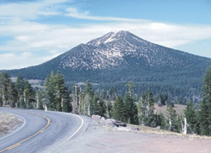
View of Mount Scott from the southwest |
||
| height | 2722 m | |
| location | Oregon , USA | |
| Mountains | Cascade chain | |
| Coordinates | 42 ° 55 '25 " N , 122 ° 0' 53" W | |
| Topo map | USGS Crater Lake East | |
|
|
||
| Type | Stratovolcano | |
| Age of the rock | 420,000 years | |
Mount Scott is a stratovolcano in the US state of Oregon . It is part of the Cascade Range and is just four kilometers east of Crater Lake . Mount Scott is the highest point in Crater Lake National Park and is 917 meters high . There is a forest fire watchtower on the summit . This is located at the end of a path that leads up the mountain for a short distance of around 500 meters. The volcano was named after the place Scottsburg , or its founder Levi Scott .
photos
Web links
Commons : Mount Scott (Klamath County, Oregon) - Collection of pictures, videos, and audio files
- Mount Scott on Peakbagger.com (English)
- Summitpost.org: Information and photos (English)
Individual evidence
- ^ Corning, Howard M. Dictionary of Oregon History . Binfords & Mort Publishing, 1956.


