Mpanda
| Mpanda | ||
|---|---|---|
|
|
||
| Coordinates | 6 ° 21 ′ S , 31 ° 4 ′ E | |
| Basic data | ||
| Country | Tanzania | |
| Katavi | ||
| ISO 3166-2 | TZ-28 | |
| Residents | 102,000 (2012) | |
Mpanda is a city in the East African state of Tanzania . It is the capital of the west of the country on Lake Tanganyika situated, in 2012 by dividing the region Rukwa created Region Katavi .
geography
Like many cities in Africa, Mpanda has grown rapidly in recent years; in 2002 the population was 67,890. The city administration gives the population for 2012 as 102,000. This corresponds to annual growth of 4.2 percent and a doubling rate every 16.7 years. One reason for the increase in population is immigration from the surrounding area and from other regions.
Mpanda lies at an altitude of 1097 meters above sea level on the Mpanda River, which flows south and flows into the Katavi Lake, which has no drainage . The climate is tropical, Aw according to the effective climate classification . The precipitation averaging 1,139 millimeters per year falls mostly in the rainy season from November to April, especially the months June to September are very dry. The average temperature is balanced, the coolest month is July with 22.7 degrees Celsius, the warmest month is October with 26.2 degrees.
Facilities and services
- Health: A hospital, three health centers and fifteen pharmacies are available to provide medical care for the population (as of 2014).
- Education: In 2014 the council had 53 primary schools with 672 teachers teaching 7013 students. Of the nine secondary schools, eight were state and one private. The state schools were attended by 636 students.
populationThe largest ethnic group in and around the city are the Bende , who make up almost eighty percent of the population. The literacy rate for those over fifteen rose from seventy percent in 2002 to over eighty percent in 2012. That year, around sixty percent spoke Swahili and over twelve percent spoke English and Swahili. Economy and Infrastructure |
 |
- Economy: In 2012, two thirds of Mpanda City's households were engaged in agriculture. Maize, rice, beans, cassava and sweet potatoes were grown for their own use, while tobacco, cotton, sunflower seeds, honey, peanuts and sesame were intended for sale .
- Railway: The city is the end of the railway line from Kaliua via Ugalla to Mpanda.
- Airport: In the southeast of the city is the Mpanda Airport, which was modernized in 2012 with state and United Nations funds and expanded to a runway length of 1,820 meters. Air Tanzania offers three connections a week with Dar es Salaam , the return flight with a stopover in Tabora (as of 2020).
- Roads: Mpanda is the intersection of the national roads T9 and T23. The T9 connects Zambia via Sumbawanga in the south with Burundi in the north. The T23 leads east to the T8 to Tabora and Rungwa .
religion
The city of Mpanda has been the seat of a Catholic bishop since October 23, 2000, when the new diocese of Mpanda was spun off from the diocese of Sumbawanga .
Others
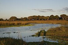
- Katavi National Park : This 4,471 square kilometer national park is 36 kilometers south of the city. It is the third largest national park in Tanzania and offers plains rich in game with miombo forests. Numerous water birds, crocodiles and hippos live in the Katavi and Chada lakes.
Web links
Individual evidence
- ^ World Gazetteer: Mpanda - data profile and name variants. Retrieved January 23, 2010 .
- ↑ personal communication from Mr. Lukanga Suleiman, City Council Director, to Martin Regelsberger on August 29, 2013
- ^ Tanzania Regional Profiles, 23 Katavi Regional Profiles. (PDF) The United Republic of Tanzania, 2016, p. 15 , accessed on March 15, 2020 .
- ↑ a b History. Retrieved March 16, 2020 .
- ↑ Maps for thr World, Map 500k - xb36-3. Russian Army Maps, accessed March 15, 2020 (Russian).
- ↑ Mpanda climate: Average Temperature, weather by month, Mpanda weather averages - Climate-Data.org. Retrieved March 15, 2020 .
- ↑ Strategic Plan 2016 / 17–2020 / 21. (PDF) Mpanda Disgtrict Council, November 2016, p. 15 , accessed on March 15, 2020 .
- ↑ Strategic Plan 2016 / 17–2020 / 21. (PDF) Mpanda Disgtrict Council, November 2016, pp. 9, 12 , accessed on March 15, 2020 .
- ↑ Strategic Plan 2016 / 17–2020 / 21. (PDF) Mpanda Disgtrict Council, November 2016, p. 6 , accessed on March 15, 2020 .
- ^ Tanzania Regional Profiles, 23 Katavi Regional Profiles. (PDF) The United Republic of Tanzania, 2016, pp. 65, 69 , accessed on March 15, 2020 .
- ^ Tanzania Regional Profiles, 23 Katavi Regional Profiles. (PDF) The United Republic of Tanzania, 2016, p. 119 , accessed on March 15, 2020 .
- ^ Trunk Roads Network. Retrieved March 15, 2020 .
- ↑ Daily News Online Edition - Vice-President opens Mpanda airport. January 29, 2013, accessed March 16, 2020 .
- ^ Air Tanzania. Retrieved March 16, 2020 .
- ^ Tanzania Trunk Road Network. Retrieved March 15, 2020 .
- ^ Mpanda (Latin (or Roman) Diocese). Catholic-Hierarchy, accessed March 15, 2020 .
- ↑ Sitalike to Mpanda. Google Maps, accessed March 15, 2020 (de-US).
- ↑ Tanzania in Figures 2018. (PDF) National Bureau of Statistics, June 2019, p. 8 , accessed on March 15, 2020 .
- ↑ Katavi National Park. In: Tanzania Travel & Information Portal. May 2, 2016, accessed on March 15, 2020 (German).

