Napasorsuaq
| Napasorsuaq | ||
|---|---|---|
|
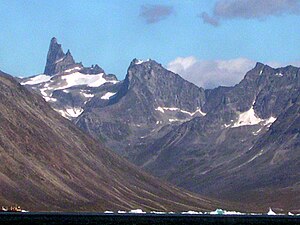
Napasorsuaq from the west, in the foreground the Kirkespirdalen |
||
| height | 1590 m | |
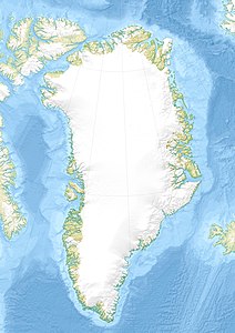
| location | Tasermiutfjord, Nanortalik Municipality , South Greenland | |
| Coordinates | 60 ° 21 ′ 0 ″ N , 44 ° 44 ′ 0 ″ W | |
|
|
||
| rock | granite | |
| particularities | Gold mine | |
|
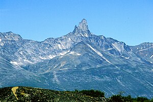
Napasorsuaq from the southeast |
||
The Napasorsuaq , also in Danish Kirkespiret (German: church tower ), is a 1590 m high mountain in the south of Greenland .
The Napasorsuaq is located in the municipality of Nanortalik on the west bank of the Tasermiut fjord . It is the highest peak of a mountain range that runs in a southwest-northeast direction and reaches heights of up to 1400 m . Compared to its neighbor, the Nuussuup Qaqqaa , which is much lower at 1302 m , the Napasorsuaq is hardly glaciated , to the west, south-west and south of the steep summit pyramid there are only small firn fields . In the west extends the Kirkespirdalen (Kirkespiret valley) named after the mountain , which flows into the Saqqa Fjord in a southeast direction. Gold has been mined in Kirkespirdalen since 2004 . The Nalunaq gold mine ( Greenlandic : hard-to-find place ) is the first gold mine in Greenland.
Napasorsuaq is popular with climbers for its solid granite rock , which is similar to that of the nearby Ketil and Ulamertorsuaq mountains . On the west and east walls, routes set up by Austrian mountaineers lead to the summit. The 400 meter high north face was first climbed in 1998 by a Danish rope team (Route Gold Fever , 6b A1 ).
literature
- K. Secher, H. Stendal & BMStensgaard: The Nalunaq Gold Mine . In: Karsten Secher, GEUS (Ed.): Geology and Ore . No. February 11 , 2008, ISSN 1602-818X , p. 2–12 ( geus.dk [PDF; accessed March 24, 2008]).
- Greenland Tourism: Hiking Map South Greenland / Tasermiut fjords - Nanortalik . 1996 (hiking map in English).
Individual evidence
- ↑ The wrong altitude is often found at 1287 m
- ↑ Michael Hjorth: Ketil Fjeld, South Greenland, 1987. bigwall.dk, accessed on March 24, 2008 (English).
- ↑ Doug Byerly: Kirkespiret, North Face, Previously Unreported . In: American Alpine Club (Ed.): American Alpine Journal . 2000, ISSN 0065-6925 , p. 245 .


