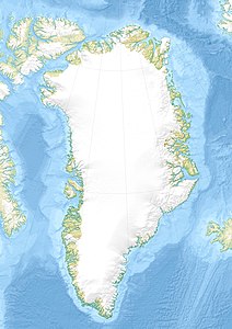
Ulamertorsuaq
| Ulamertorsuaq | ||
|---|---|---|
|
Ulamertorsuaq as seen from Tasermiutfjord (from the west) |
||
| height | 1858 m | |
| location | Tasermiutfjord, Greenland | |
| Coordinates | 60 ° 22 ′ 30 ″ N , 44 ° 31 ′ 30 ″ W | |
|
|
||
| rock | granite | |
| First ascent | 1977 by Agier / Payrau / Vigier: Route Magic Tromblon ( VI, A2 ) | |
The Ulamertorsuaq (according to the old spelling Ulamertorssuaĸ , German large cylinder ) is a mountain in the south of Greenland , which has achieved alpine importance due to its difficult west face .
The mountain is near the town of Nanortalik on Tasermiut Kangerluat (Ketilsfjord). The summit region is strongly structured, there are four summit points with heights of 1858 m , 1843 m , 1829 m and 1825 m , of which the 1843 m high western summit is the most important in alpine terms. There are two smaller glaciers on the northwest and northeast sides.
Similar to its higher neighbor Ketil , the Ulamertorsuaq is characterized by its granite walls up to 1000 m high. The west wall in particular has a reputation among climbers as one of the most challenging big walls on earth, comparable to El Capitan or Cerro Torre . In 1977 the Ulamertorsuaq was first climbed by a French rope team. In 1994, Stefan Glowacz , Kurt Albert and companions set up what is probably the most famous route, Moby Dick ( IX + / A2 ). It was first freely climbed by a Slovak team in 1998 .
swell
- ^ Kurt Albert : Ulamertorssuaq, Moby Dick . In: American Alpine Club (Ed.): American Alpine Journal . 1996, ISSN 0065-6925 , p. 205–207 ( rackcdn.com [PDF; accessed October 8, 2012]).
- ↑ Vlado Linek: The Summer 1998 Slovak Expedition to Greenland. Jamesák International, accessed March 23, 2008 .
literature
- Greenland Tourism: Hiking Map South Greenland / Tasermiut fjords - Nanortalik . 1996.

