Nass River
| Nass River | ||
|
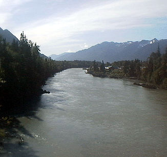
Nass River at Gitwinksihlkw |
||
| Data | ||
| location | British Columbia ( Canada ) | |
| River system | Nass River | |
| origin |
Nass Lake in the Skeena Mountains 57 ° 8 ′ 51 ″ N , 129 ° 5 ′ 48 ″ W |
|
| Source height | 1126 m | |
| muzzle | to Nass Bay ( Portland Inlet ) Coordinates: 54 ° 58 ′ 37 " N , 129 ° 53 ′ 22" W 54 ° 58 ′ 37 " N , 129 ° 53 ′ 22" W |
|
| Mouth height | 0 m | |
| Height difference | 1126 m | |
| Bottom slope | 3 ‰ | |
| length | 380 km | |
| Catchment area | 21,100 km² | |
| Discharge at the gauge above Shumal Creek A Eo : 18,400 km² |
MQ 1929/2012 Mq 1929/2012 |
782 m³ / s 42.5 l / (s km²) |
| Right tributaries | Konigus Creek , Taylor River , Bell-Irving River , Meziadin River , Kinskuch River | |
| Navigable | 40 km | |
|
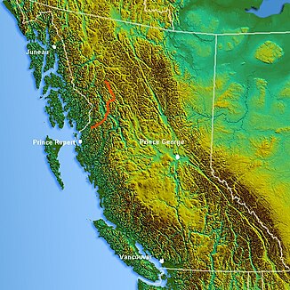
Course of the Nass River |
||
The Nass River is a 380 km long river in the Canadian province of British Columbia .
Wet is a Tlingitic word that roughly corresponds to the translation “storage warehouse”.
It rises in the Skeena Mountains and flows 380 km into Nass Bay , a side bay of Portland Inlet . The Nass River is only navigable for the last 40 km. The mean discharge is over 780 m³ / s.
The river is also in the danger zone of the active volcano Tseax Cone . In the event of an outbreak, the river would be at great risk of being dammed. In addition, this would be a catastrophe for the local salmon fishery, at least in the short term .
Web links
Commons : Nass River - Collection of Images, Videos, and Audio Files
- Nass River . In: BC Geographical Names (English)
Individual evidence
- ^ A b The Atlas of Canada - Rivers
- ↑ Water Survey of Canada: Station 08DB001 ( Memento of the original from December 24, 2010) Info: The archive link was automatically inserted and not yet checked. Please check the original and archive link according to the instructions and then remove this notice.

