Natkiškiai
| Natkiškiai | ||
|
||
| State : |
|
|
| District : | Tauragė | |
| Municipality : | Pagėgiai | |
| Office : | Natkiškiai | |
| Founded : | before 1740 | |
| Coordinates : | 55 ° 14 ′ N , 21 ° 57 ′ E | |
| Inhabitants (place) : | 580 (2011) | |
| Time zone : | EET (UTC + 2) | |
| Postal code : | 99232 | |
| Status: | Village | |
|
|
||
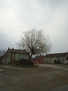
Natkiškiai ( German Nattkischken ) is a village in the Tauragė district of Lithuania . The place is the center of the administrative district (Seniūnija) Natkiškiai and belongs to the municipality of Pagėgiai .
Geographical location
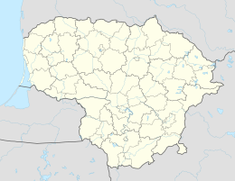
Natkiškiai is located in the southwest of Lithuania , in the former Memelland , about eleven kilometers north of the municipality of Pagėgiai . Road 4201 runs through the village and can be reached from Pagėgiai.
Place name
The name points to the vegetation with nettles and the location at a bend in the river: Prussian "natis" = nettle, and "kiska" = river bend , also the hollow of the knee.
history
The place was founded before 1740 and was (presumably) since 1874 the seat of an administrative district in the (rural) district of Tilsit . Nattkischken had an Evangelical Lutheran church since 1904. In 1920 it was incorporated into the Pogegen district (lit. Pagėgių apskritis). From 1939 to 1944 the place was in the district of Tilsit-Ragnit . The church was destroyed in 1944.
After incorporation into the Lithuanian Soviet Socialist Republic , Natkiškiai was initially the seat of a community (lit. valsčius) in the Pagėgiai district (lit. Pagėgių apskritis). In 1950, the municipality and the district were dissolved and replaced by the district (lit. apylinkė) or Rajon. Since 1962 the district was located in the Šilutė district and was initially partially (1963) and then fully (1974) connected to the Pagėgiai district. Natkiškiai has belonged to the Pagėgiai District since 1995 and has been the seat of its own district within the Pagėgiai Municipality since 2001 . As the seat of an administrative district, the place got a coat of arms in 2014.
Population development
| year | Residents |
|---|---|
| 1910 | 467 |
| 1925 | 446 |
| 1959 | 305 |
| 1970 | 367 |
| 1979 | 547 |
| 1989 | 735 |
| 2001 | 724 |
| 2011 | 580 |
school
There is a secondary school in Natkiškiai, which is named after the paramedic Zosės Petraitienės from Natkiškiai, who died in 1982 during an aid operation for a woman giving birth in a snow storm.
Natkiškiai District
The Natkiškių seniūnija, which is assigned to the municipality of Pagėgiai , has existed since 2001 . The administrative district includes 13 villages and four single seats (lit. viensėdis) with a total of 824 inhabitants on an area of 52.1 km². (Status 2011). However, four of these locations are uninhabited; they are marked with an * in the following table. The district includes:
| Place name | German name | status | Place name | German name | status | |
|---|---|---|---|---|---|---|
| Daubarai | Jurge-Kanscheit | Village | Ropkojai | Robbeds | Village | |
| Endrikaičiai * | Endricates | Single seat | Sauliai | Joseph-Grutscheit | Single seat | |
| Gailiškiai * | Single seat | Skrodliai * | Scrodding | Single seat | ||
| Giegždai | Jögsden | Village | Smukutė | Village | ||
| Kiūpeliai | Pegs | Village | Šlepai | Towing | Village | |
| Kuturiai * | Kutturren | Village | Tamošaičiai | Thomuscheiten | Village | |
| Minjotai | Gallus-Wilpien | Village | Timsriai | Tim star | Village | |
| Natkiškiai | Nattkischken | Village | Žemučiai | Village | ||
| Pėteraičiai | Peterates | Village |
Web links
Individual evidence
- ↑ census data


