Pagėgiai
| Pagėgiai / Pogegen | |||
|
|||
| State : |
|
||
| District : | Tauragė | ||
| Municipality : | Pagėgiai | ||
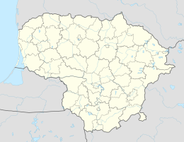
| Coordinates : | 55 ° 8 ′ N , 21 ° 54 ′ E | ||
| Community area : | 537 km² | ||
| Inhabitants (place) : | 4,283 (2016) | ||
| Inhabitant (municipality) : | 10.122 | ||
| Population density : | 0 inhabitants per km² | ||
| Time zone : | EET (UTC + 2) | ||
| Postal code : | 99032 | ||
| Status: | Municipality, office and its core city |
||
| Website : | |||
|
|
|||
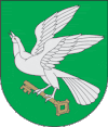
Pagėgiai ( German Pogegen , 1943-1945 Ordenswalde ) is the core town of the municipality Pagėgiai in the Tauragė district , Lithuania , as well as the seat of the administrative district (Seniūnija) Pagėgiai.
geography
The city is located on the north bank of the Memel River , which forms the border between Lithuania and the Russian Kaliningrad Oblast . On the opposite bank is the city of Sovetsk , the former Prussian city of Tilsit. There is a road connection between the two cities that continues to Riga in Latvia . The Sovietsk - Riga and Pagėgiai - Klaipėda railway lines also run through Pagėgiai .
history
The first reliable mention of the place comes from the year 1307. The name means "On the river Gege / Jäge" (pr. Pa: an; Gegis: grove, alder forest, hay meadows, fields). It was the time when the Teutonic Order had completed its north-eastern advance in the course of the Christianization of the Prussians . Since German farmers had little interest in colonizing the wilderness north of the Memel, mainly Lithuanian refugees moved there who were unable to practice their faith in their still pagan homeland. Because of the largely inaccessible landscape, the border between the monastic state and Lithuania was indefinite for a long time; it was only contractually established in 1398. After that, the village of Pagėgiai or Pogegen was administered by the Ragnit Order Commandery . Under the influence of the Ragniter Schalauerburg, Germanness radiated further north, so that the former Lithuanian immigrants assimilated more and more and in many cases adopted the German language as a second language.
The inhabitants of Pogegen lived mainly from agriculture and fishing on the Memel. Until the 18th century they shared the fate of Memelland, which repeatedly suffered from incursions by Lithuanians, Russians and Swedes as well as from plague and cholera. Conditions only improved in the middle of the 19th century. The proximity to the up-and-coming Ragnit, which wanted to expand its trade relations to the north, helped Pogegen to connect to the newly created modern traffic routes, such as the Chaussee towards Riga and the Memel - Tilsit - Insterburg railway line, which was completed on October 15, 1875. On August 12, 1902, the Pogegen - Schmalleningken small railway was opened, with which the region to the east was also opened up to traffic. With 684 inhabitants, which were determined in both 1885 and 1910, Pogegen remained a relatively insignificant place, with only a few shops and handicrafts as well as an inn, two restaurants, a cheese dairy, a beer publisher and a cattle trading company.
At the beginning of the First World War , the place was temporarily conquered by Russian troops in autumn 1914. After the end of the war, the areas north of the Memel were separated from Prussia in the Versailles Treaty in 1919, subject to a later state allocation . The now so-called Memelland was placed under French military administration on February 15, 1920 and divided into new administrative areas. Because of its convenient location, Pogegen was designated as the seat of the administration of the newly created district of the same name . Since the place so far mainly consisted of a collection of rural farms, the first district administrator appointed by the French, the German government assessor Count Hardenberg, was forced to build a completely new infrastructure. This also included the incorporation of the neighboring village of Benningkeiten. On January 10, 1923 (the day before the French occupation of the Ruhr ), Lithuanian soldiers, disguised as militants, occupied Memelland in breach of the Versailles Treaty. The League of Nations was forced to agree to the annexation of Memel Land in the Lithuanian state, but achieved a statute of autonomy under its supervision. With the influx of staff for the district administration, Pogegen developed rapidly. Numerous new craft businesses emerged, a business district was built near the train station, an agricultural secondary school and a Lithuanian high school were opened. A separate power station was built for the energy supply. In 1925 the number of residents more than doubled to 1,404. At that time, however, the large rural community still did not have its own church; it still belonged to the Tilsit-Land parish . Since the Tilsit church was becoming more and more difficult to reach because of the demarcation of the boundary, a small church was built in Pogegen in 1933, to which a tower was added in 1938.
The authoritarian head of the Lithuanian government Antanas Smetona , who came to power in 1926, had to return Memelland to Germany on March 22, 1939 under German pressure . Due to a reorganization of the districts, Pogegen lost its status as a district town on October 1, 1939 and was incorporated into the Tilsit-Ragnit district with 2,761 inhabitants . During the Second World War, the German Wehrmacht maintained a prisoner-of-war camp for officers in Pogegen. It was not until March 23, 1943, that the municipality of Pogegen was given city rights by renaming its name to "Ordenswalde". In the last phase of the war, Pogegen, which had already suffered destruction during retreats by the German Wehrmacht, was captured by the Soviet Red Army on October 20, 1944. In 1947 the formerly German areas north of the Memel were added to the Soviet Union Republic of Lithuania. Pogegen received its Lithuanian place name Pagėgiai and was again a district town after it was spun off from the Šilutė district . In 1959 there were 3,436 inhabitants.
Twin town
-
 Bad Iburg , since 1993
people
- Mindaugas Stakvilevičius (* 1931), Lithuanian politician, member of the Seimas
Pagėgiai District
The Pagėgių seniūnija has existed since 1995, which belonged to the Rajongemeinde Šilutė until 1999 and has since been assigned to the Pagėgiai municipality . In the district there are 24 villages and the two cities Pagėgiai and Panemunė with a total of 4,998 inhabitants on an area of 140.5 km² (as of 2001). In 2001, the Natkiškiai District was spun off from the Pagėgiai District. Since 2009, the administrative district has been divided into five subdistricts (lit. Seniūnaitija) Kentrina seniūnaitija, Pagėgių kaimiškoji seniūnaitija, Pagėgių miesto seniūnaitija, Panemunės seniūnaitija and Piktupėnų seniūnaitija. The district includes:
| Place name | German name | Subdistrict | Place name | German name | Subdistrict | |
|---|---|---|---|---|---|---|
| Bajėnai | Buoyends | Pagėgiai land | Mikytai | Miekiten | Piktupėnai | |
| Benininkai | Benefits | Pagėgiai land | Pagėgiai (village) | to Pogegen | Pagėgiai land | |
| Birštoniškiai | Birstonishks | Piktupėnai | Pagėgiai (city) | But against | Pagėgiai city | |
| Būbliškė | Building | Pagėgiai land | Panemunė | Overmemel | Panemunė | |
| Eisraviškiai | Eistrawischken | Pagėgiai land | Pavilkiai | Powilken | Pagėgiai land | |
| Endriškiai | Heinrichsthal | Piktupėnai | Piktupėnai | Icon tones | Piktupėnai | |
| Geniai | Kullmen-Jennen | Piktupėnai | Plaušvariai | Chatting | Pagėgiai land | |
| Grigolaičiai | Grigoleiten | Pagėgiai land | Strepeikiai | Sterpeiken | Piktupėnai | |
| Gudai | Gudden | Pagėgiai land | Sūdėnai | Shudder | Pagėgiai land | |
| Jonikaičiai | Jonikaten | Pagėgiai land | Užbaliai | Uszballen | Piktupėnai | |
| Kentriai | Kullmen-Szarden | Kentriai | Vėlaičiai | Uszkullmen | Kentriai | |
| Kulmenai | Kullmen Kulken | Kentriai | Vidgiriai | Wittgirren | Piktupėnai | |
| Mantvilaičiai | Mantwillaten | Pagėgiai land | Vydutaičiai | Kullmen re-doing | Piktupėnai |
Web links
literature
- Fritz Brix : Tilsit-Ragnit. City and county. An East Prussian homeland book. (= East German contributions. From the Göttingen working group. 50). Würzburg 1971, DNB 458346888 .
- Heinrich A. Kurschat: The book from Memelland. Oldenburg (Oldb) 1968, DNB 457326395 .
- Ernst A. Plieg: The Memelland 1920–1939. Würzburg 1962, DNB 364474653 .
Individual evidence
- ↑ Liūdnas pasienio savivaldybės likimas (Alfa.lt)
- ↑ http://lietuvos.istorija.net/kleinlitauen/almonaitis.htm
- ↑ This is what the former mayor of Pogegen and Ordenswalde, Richardt Brandt, wrote on page 90 f. of the book "Der Kreis Tilsit-Ragnit" by Fritz Brix


