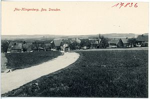
Neuklingenberger Höhe
| Neuklingenberger Höhe | ||
|---|---|---|
|
View from Neuklingenberger Höhe to Neu-Klingenberg, 1914 |
||
| height | 476.3 m | |
| location | Colmnitz , Free State of Saxony , Germany | |
| Mountains | Erzgebirge foothills | |
| Coordinates | 50 ° 54 '44 " N , 13 ° 31' 8" E | |
|
|
||
| particularities | Triangulation column | |
The Neuklingenberger Höhe ( 476.3 m ) is an unforested hilltop in the foothills of the Ore Mountains near Neuklingenberg in the Saxon Switzerland-Eastern Ore Mountains district in Saxony .
geography
The Neuklingenberger Höhe rises southwest of Neuklingenberg on the Colmnitz district in the municipality of Klingenberg . The parish bush is on the western slope; To the east and south-east, the Klingenberg Forest extends to the Wild Weißeritz valley and the Klingenberg dam . To the south and south-west the mountain falls to the valley of the Colmnitzbach , in which the elongated forest hoof village of Colmnitz extends. The Seerenbach rises at the northwestern foot of the mountain , the Dorfbach to the north, the Pfarrgrundbach to the northeast and the Lange Grundbach to the east .
description
On the summit of the Neuklingenberger Höhe there is a water tank surrounded by bushes and the triangulation stone No. 78 Klingenberg of the Royal Saxon Triangulation . A quarry used to be operated on the western side of the summit. At the beginning of the 20th century, the no longer preserved Dr. Grobe cross was on the summit .

