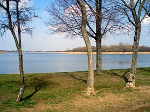
Neustädter See (Magdeburg)
| Neustädter See | ||
|---|---|---|

|
||
| View from the south bank | ||
| Geographical location | Saxony-Anhalt | |
| Data | ||
| Coordinates | 52 ° 10 '38 " N , 11 ° 38' 42" E | |
|
|
||
| surface | 60 ha | |
| Maximum depth | 6 m | |
|
particularities |
||
The Neustädter See is a lake in the Magdeburg district of Magdeburg-Neustädter See .
description
It has a size of 60 hectares and is fed by groundwater . The depth is six meters at the deepest point. Perch , pike and eel can be found in the lake, which is also used for fishing . In total, there are up to 10 reported fish species. In the warmer seasons, the Neustädter See is heavily used as a bathing lake, and there is also a water ski facility. There is a bathing establishment on the south bank and a nudist bathing establishment on the east bank .
The lake owes its creation to the gravel quarrying that took place here . During the GDR era, in particular , large quantities of gravel were extracted here to rebuild Magdeburg after the destruction of the Second World War and to build the neighboring residential area of Magdeburg-Neustädter See. In 1975 the local recreation center on the south bank of the lake was officially opened.

