Niijima
| Niijima | ||
|---|---|---|
| Landsat image of Niijima (right) | ||
| Waters | Pacific Ocean | |
| Archipelago | Izu Islands | |
| Geographical location | 34 ° 22 ′ 0 ″ N , 139 ° 16 ′ 0 ″ E | |
|
|
||
| surface | 22.96 km² | |
| Highest elevation | Miyatsuka 432 m |
|
| Residents | 2400 105 inhabitants / km² |
|
| main place | Niijima | |
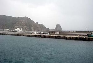
| The port of Niijima | ||
Niijima ( Japanese 新 島 , dt "new island") is a volcanic island in Japan . The area is 22.96 km² and the population is 2400. As one of the Izu Islands, it belongs administratively to the Tokyo Prefecture .
To the southwest is the island of Shikine-jima , 1000 m west of Jinai-tō ( 地 内 島 ) and 300 m south of Hanshima ( 早 島 ; occasionally misread as Hayashima). With these smaller islands, Niijima forms the village of Niijima ( 新 島村 , -mura ), with only Niijima and Shikine-jima being inhabited.
The highest point is the Miyatsuka lava dome ( 宮 塚 山 , -yama ) with 432 m. Other lava domes in the south and north of the island bear witness to the last volcanic eruptions in the 9th century.
Niijima is a popular destination for day and weekend tourists from the Tokyo metropolitan area . The east side of the island is a diving area , the west side, Habushi Beach, attracts many surfers . The main holiday season is in the Obon week in August. There are three hot springs ( onsen ) on the island , from which salty sea water gushes.
The island's local specialty is dried fish ( kusaya ), milk senbei and ashitaba . Ashitaba ( 明日 葉 , scientific name: Angelica keiskei ) is a plant that got its name (morning leaf) from the fact that a torn off leaf grew back the next morning. It is used to color soba noodles green and deep-fried as tempura .
As a further tourist attraction, the island offers a workshop with a museum for glass art, in which a stone called koga is processed into green glass.
There is also a Self-Defense Forces Research Center on the island with a launch pad for experimental and sounding rockets .
The island can be reached from Tokyo by ferry in seven hours, by hydrofoil in 2½ hours, by plane from Chofu Airport in 45 minutes and by helicopter .
Web links
- Niijima in the Global Volcanism Program of the Smithsonian Institution (English)
- Niijima Volcano Group in the Japanese Volcanoes Quaternary database (English and Japanese)
- Information on the rocket launch site on Niijima in the Encyclopedia Astronautica (English)
Individual evidence
- ↑ 島 面積 . (PDF; 144 kB) (No longer available online.) Kokudo Chiriin , October 1, 2014, archived from the original on April 2, 2015 ; Retrieved July 29, 2016 (Japanese). Info: The archive link was inserted automatically and has not yet been checked. Please check the original and archive link according to the instructions and then remove this notice.
- ↑ for the reading cf. Akira Yasuda, Ichiyo Isobe: 伊豆 新 島 南 東部 に お け る 大海 食 崖 の 後退 に つ い て - 空中 写真 を 用 い た 火 砕 丘 の 侵 食量 の 測定 - . In: Bull. Geol. Surv. Japan . Vol. 46, No. 9 , 1995, p. 457-475 ( gsj.jp [PDF]).


