Nilgiri Parbat
| Nilgiri Parbat | ||
|---|---|---|
| height | 6474 m | |
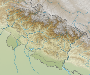
| location | Uttarakhand ( India ) | |
| Mountains | Kamet Group ( Garhwal Himalayas ) | |
| Coordinates | 30 ° 46 '59 " N , 79 ° 38' 44" E | |
|
|
||
| First ascent | July 1937 by Frank Smythe with Wangdi and Nurbu. | |
| Normal way | glaciated alpine tour | |
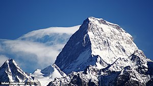
The Nilgiri Parbat is a 6,474 m high mountain in the Garhwal region in the Himalayas in the Indian state of Uttarakhand .
location
The Nilgiri Parbat is located on the north side of the valley known as the Valley of Flowers in the Valley of Flowers National Park . Its southern neighbors are Rataban , Ghori Parbat and Hathi Parbat , and the Kamet group to the north .
Surname
The name was given by RA Gardiner, a lieutenant in the British Survey of India .
First ascent
The first ascent succeeded the British Himalayan pioneer Frank Smythe together with two Tibetan porters in July 1937 over the north side, after an attempt from the Valley of Flowers had proven too difficult.
Web links
- Captain Suma N. Dubey: Mana Nilgiri Expedition 1962 . In: The Himalayan Club (ed.): Himalayan Journal . tape 24 , 1963 (English, online [accessed November 20, 2011]). with overview maps, Central Garhwal
Individual evidence
- ^ Frank S. Smythe: The Valley of Flowers. 1949, p. 142.Available online at www.archive.org, accessed November 22, 2011.
- ^ Frank S. Smythe: The Valley of Flowers. 1949, pp. 154-169. Available online at www.archive.org, accessed November 22, 2011.

