Hathi Parbat
| Hathi Parbat | ||
|---|---|---|
| height | 6727 m | |
| location | Uttarakhand ( India ) | |
| Mountains | Kamet Group ( Garhwal Himalayas ) | |
| Dominance | 23.37 km → Mana | |
| Notch height | 1673 m ↓ Bhundar Khal | |
| Coordinates | 30 ° 41 '6 " N , 79 ° 42' 21" E | |
|
|
||
| First ascent | June 6, 1963 by an Indian expedition under Sonam Gyatso | |
| Normal way | glaciated alpine tour | |
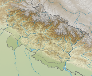
Hathi Parbat (also Haathi Parvat or Elephant Peak ) is a 6727 m high mountain in the western Himalayas in the Garhwal region in the Indian state of Uttarakhand .
The Hathi Parbat is located in the south of the Kamet group . It is located in the Nanda Devi National Park .
The Hathi Parbat was first climbed on June 6th and 7th, 1963 by seven mountaineers under the direction of Sonam Gyatso. On the first day Lhakpa Tenzing, HGS Rawat and Thondup Tsering, son-in-law of Tenzing Norgay , reached the summit, followed the next day by Dawa Norbu, DS Sisodia, Sonam Wangyal and Lieutenant Kaushal from the Maratha Light Infantry.
Web links
- Hathi Parbat on Peakbagger.com (English)
- Eberhard Jurgalski , Jonathan de Ferranti, Aaron Maizlish: The Karakoram, Pakistan Himalaya and India Himalaya (north of Nepal). 68 Mountain Summits with Prominence of 1,500 meters or greater. 2005, accessed November 29, 2014 .
Individual evidence
- ↑ DC 50 years ago: Hathi Parbat scaled. (No longer available online.) In: Deccan Chronicle. June 27, 2013, archived from the original on December 4, 2014 ; accessed on November 29, 2014 (English). Info: The archive link was inserted automatically and has not yet been checked. Please check the original and archive link according to the instructions and then remove this notice.

