North Stradbroke Island
| North Stradbroke Island | ||
|---|---|---|
| Left: View of the northern tip of North Stradbroke Island | ||
| Waters | Coral sea | |
| Geographical location | 27 ° 35 ′ S , 153 ° 28 ′ E | |
|
|
||
| length | 38 km | |
| width | 11 km | |
| surface | 275.2 km² | |
| Highest elevation | Mount Hardgrave 219 m |
|
| Residents | 2026 (2011) 7.4 inhabitants / km² |
|
| main place | Dunwich | |
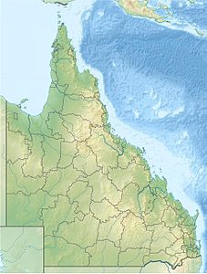
| Location of the island in Queensland | ||
North Stradbroke Island is a large sand island on the east coast of Australia . It is located in the south of the state of Queensland and separates Moreton Bay from the Coral Sea (a marginal sea of the Pacific Ocean ). The island is about 38 kilometers long and up to 11 kilometers wide. It is the larger of the Stradbroke Islands and the largest island in Moreton Bay by area.
history
Until 1896, South Stradbroke Island was part of the large sandy island of Stradbroke Island . Stradbroke Island was passed by James Cook in 1770 , but remained nameless. In 1803 the explorer Matthew Flinders landed on the island to replenish the drinking water supplies of his ship. Flinders mapped large parts of the island and Moreton Bay. He also took over the Aboriginal name of the island of Minjerribah .
It was not until 1827 that the island was named Stradbroke Island. This was done through Henry John Rous . He named the island after the title of his father, the Earl of Stradbroke . Rous himself carried the title of Viscount Dunwich, after which he named the capital of the island.
In the early 1890s, a cargo ship loaded with rum ran aground on the sea side of the island. In order to remove the rum, the inhabitants of the region removed the sand dunes on the island in order to transport the rum more easily over the island, which is quite narrow at this point, and to transport it on small boats through Moreton Bay to the mainland. In 1896 there was a great storm in which a large steamship stranded at the same place. Among other things, this had loaded a few tons of dynamite, which exploded after the ship was stranded. The strong surf during the storm meant that this rather narrow and flat part of the island was washed over and a permanent channel was soon created. This channel, which was named Jumpinpin Channel , divided the island into North Stradbroke Island and South Stradbroke Island .
Commercial mining of sand began on North Stradbroke Island in the 1960s. The large sand dunes along the east coast of the island were first excavated before mining began in the interior of the island. During this dismantling work, the island's ecosystem was severely damaged, as well as numerous historic shipwrecks along the coast and Aboriginal places of worship.
There were also plans by the Queensland government to develop the island for tourism on a large scale. For this purpose, the east coast of the island should be fully developed and a large bridge between the mainland and the island built. These plans never came to fruition.
As environmental awareness grew in the early 1990s, plans were developed to limit sand mining on the island and to place large parts of the island under protection in a national park. In return, the unimpeded extraction of sand in the remaining areas should be guaranteed. The draft agreement has not yet been signed by the mining companies or the government.
present
North Stradbroke Island is the better developed of the two Stradbroke Islands. There are three permanent settlements on it. These are Dunwich, Amity Point, and Point Lookout. Dunwich is the largest of the three settlements. This owns the ferry terminal for car and passenger ferries to Cleveland on mainland Queensland. Amity Point is the oldest of the three settlements. Today it is a small fishing port, which is particularly popular with sport and amateur anglers. Point Lookout is the island's tourist center. All three places offer a sufficient infrastructure with overnight accommodation, restaurants and shops. The places are connected by a network of paved roads.
tourism
North Stradbroke Island is very well developed for tourism and offers visitors a variety of options. Those seeking relaxation will find peace and quiet on the island's long white sandy beaches, water sports enthusiasts will find a wide range of options, and in the interior of the island there are numerous hiking, trekking and cycling routes. There are several viewing platforms along the northeast coast from which you can watch whales passing by .
Flora and fauna
Despite the destruction caused by sand mining, there are still large areas of unspoiled nature on North Stradbroke Island that are home to numerous animal and plant species. A multitude of rare wild orchids can be found in the subtropical forests on the island . In the interior of the island there are also numerous freshwater lakes, the most famous of which is the Blue Lake in the Blue Lake National Park , as well as extensive marshland.
Also worth mentioning are the numerous passing whales, which can be observed from the island. They use the protection of the coastal waters and Moreton Bay for a short rest on their way north to Hervey Bay and the Whitsundays where they give birth to their young.


