South Stradbroke Island
| South Stradbroke Island | ||
|---|---|---|
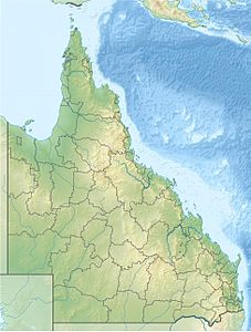
| Location of the island in Queensland | ||
| Waters | Coral sea | |
| Geographical location | 27 ° 51 ′ S , 153 ° 25 ′ E | |
|
|
||
| length | 22 km | |
| width | 2.5 km | |
| surface | approx. 50 km² | |
| Highest elevation | 18 m | |
| Residents | 101 (2011) | |
| main place | Currigee | |
South Stradbroke Island is a large sand island on the east coast of Australia . It is located in the south of the state of Queensland and separates Moreton Bay from the Coral Sea (a marginal sea of the Pacific Ocean ). The island is about 22 kilometers long and up to 2 kilometers wide. It is the smaller of the Stradbroke Islands and the furthest south island in Moreton Bay. Its southern tip is in front of the northern end of the Gold Coast .
history
Until 1896, South Stradbroke Island was part of the large sandy island of Stradbroke Island . Stradbroke Island was passed by James Cook in 1770 , but remained nameless. In 1803, the explorer Matthew Flinders landed on the island to replenish the water supply on his ship. Flinders mapped large parts of the island and Moreton Bay. He also took over the Aboriginal name of the island of Minjerribah .
It was not until 1827 that the island was named Stradbroke Island. This was done through Henry John Rous . He named the island after the title of his father, the Earl of Stradbroke . Rous himself carried the title of Viscount Dunwich, after which he named the capital of the island.
In the early 1890s, a cargo ship carrying rum ran aground on the seaside of the island. In order to remove the rum, the inhabitants of the region cleared the sand dunes on the island in order to transport the rum more easily over the island, which is quite narrow at this point, and to bring it to the mainland on small boats through Moreton Bay. In 1896 there was a great storm in which a large steamship stranded at the same place. Among other things, this had loaded a few tons of dynamite, which exploded after the ship was stranded. The strong surf during the storm meant that this rather narrow and flat part of the island was washed over and a permanent channel was soon created. This channel, which was named Jumpinpin Channel , henceforth divided the island into North Stradbroke Island and South Stradbroke Island.
In contrast to North Stradbroke Island, South Stradbroke Island was largely spared from commercial activities and the industrial mining of sand and is in a comparatively pristine state.
present
South Stradbroke Island is the less developed of the two Stradbroke Islands. There are no permanent settlements and no paved roads on it. There are only two tourist resorts and several campsites on the island. Large parts of the island are grouped together in the South Stradbroke Island Conservation Park , which prevents commercial use of the resources or mass tourism.
tourism
South Stradbroke Island lives from tourism, although this is only operated to a very limited extent. There are two resorts on the island, Couran Cove Resort and South Stradbroke Island Resort, also known as Tipplers Resort. There are also several yacht anchorages and a number of quiet and secluded campsites on the island. The beaches in the west of the island are calm and shallow, those in the east of the island offer perfect conditions for surfers.
Flora and fauna
South Stradbroke Island is mostly made up of sand and sand dunes. Large parts of the island are covered with subtropical forests, large parts of which are protected in the South Stradbroke Island Conservation Park, while some smaller areas are also actively managed. Many plants and animals have found a safe habitat in the protected forests, including the golden wallaby , which is unique to this island.

