Islas del Rosario
| Islas del Rosario | ||
|---|---|---|
| Playa Blanca on Isla Rosario | ||
| Waters | Caribbean Sea | |
| Geographical location | 10 ° 11 ′ N , 75 ° 45 ′ W | |
|
|
||
| Number of islands | 30th | |
| Main island | Isla Grande | |
| Total land area | 0.20 km² | |
| Residents | 1300 | |
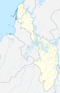
| Map of the archipelago | ||
The Nuestra Señora del Rosario archipelago belonging to Colombia , called Islas del Rosario for short ( German "Rosary Islands " ), consists of 28 small islands and is located about 40 km southwest of the center of the city of Cartagena de Indias in the Caribbean Sea and is part of its urban area.
geography
The archipelago is located west of the city of Cartagena , near the Barú peninsula . It belongs to the Department of Bolívar . The islands were formed about 5000 years ago through submarine volcanic activity.
The bigger islands are:
- Isla Grande
- Isla Rosario
- Isla Caribarú
- Isla del Tresoro , away from the other islands in the north
- Isla Arena , away from the other islands in the south
- Isla Macavi
- Isla Pavitos
- Isla San Quintin
- Isla El Peñón
- Isla San Martín
- Isla Los Pajarales
- Isla María del Mar
- Isla Majayura
- Isla Fiesta
- Isla Pirata
- Isla Cagua
History and economy
Spanish chronicles tell of the indigenous people belonging to the Caribs who were already living in the archipelago and who lived mainly from fishing when the conquistadors reached the region.
Today the Islas del Rosario, with its crystal clear water and coral reefs, is a popular excursion destination and diving area . They form one of the 52 nature national parks of Colombia and can be reached from Cartagena by (speed) boat in about 1½ hours. Cartagena is around 45 minutes by plane and 19 hours by bus from Bogotá .


