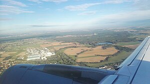
Upper forest pond
| Upper forest pond | ||
|---|---|---|

|
||
| Oberer Waldteich seen from the plane | ||
| Geographical location | Moritzburg municipality , Meißen district , Saxony , Germany | |
| Drain | → Niederer Waldteich → Promnitz → Große Röder | |
| Islands | a | |
| Location close to the shore | Boxdorf , Volkersdorf , Wilschdorf | |
| Data | ||
| Coordinates | 51 ° 8 '27 " N , 13 ° 43' 0" E | |
|
|
||
| surface | 26 ha | |
The Obere Waldteich is located in the corridor of the Moritzburg district of Boxdorf and, together with the neighboring Niedere Waldteich , belongs to the Moritzburg pond area . The 26 hectare pond was created around 1530 by the Saxon Duke Georg the Bearded and has been used primarily for the fishing industry since then. The pond has also been used for tourism since the 1920s. This resulted in two baths and a sanatorium.
Individual evidence
- ↑ Time travel through the bathing landscape of Saxony. (pdf) Society for Hygiene, Environmental Medicine and Vaccinations in Saxony eV, accessed on June 30, 2013 .
- ↑ Heiko Vogel: Place. (PDF; 817 kB) Heimatverein Boxdorf eV, accessed on June 30, 2013 .
