Ogden Reservoirs
| Ogden Reservoirs | |||||||||
|---|---|---|---|---|---|---|---|---|---|
| The Upper Ogden Reservoir | |||||||||
|
|||||||||
|
|
|||||||||
| Coordinates | 53 ° 51 '18 " N , 2 ° 17' 8" W | ||||||||
| Data on the structure | |||||||||
| Construction time: | -1906 / -1914 | ||||||||
| Data on the reservoir | |||||||||
| Total storage space : | 247,755 m³ (Upper Ogden Reservoir), 715,989 m³ (Lower Ogden Reservoir) |
||||||||
| The Lower Ogden Reservoir | |||||||||
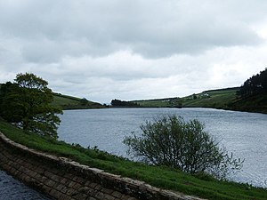
The Ogden Reservoirs are two reservoirs west of Barley on the south edge of Pendle Hill in Lancashire , England . The area in which they are located is a separate part of the AONB Forest of Bowland .
The Ogden Clough , the upper reaches of the Pendle Water, first feeds the Upper Ogden Reservoir and then flows through the Lower Ogden Reservoir east of it . The reservoirs provide drinking water for the city of Nelson and its surroundings.
The larger of the two reservoirs, the Lower Ogden Reservoir, was completed in 1914 and the Upper Ogden Reservoir was completed in 1906. In 1931 Fell Wood on the south side of the reservoirs, in 1935 Blue Wood on the north side and the neighboring Buttock Plantation were created.
Individual evidence
Web links
Commons : Ogden Reservoirs - collection of images, videos and audio files


