
Ollagüe (place)
Coordinates: 21 ° 14 ′ S , 68 ° 15 ′ W

Ollagüe is a Chilean border town in the district of the same name ( comuna ) formed in 1979 in the province of El Loa in the Región de Antofagasta in northern Chile.
Ollagüe is located in the Altiplano at an altitude of 3704 m on the national road 21 from Calama to Bolivia , at the intersection of two district roads and on the railway line from Antofagasta to Bolivia opposite the Bolivian border station Estación Avaroa, 4 km away .
The place lies between the nearby volcano Ollagüe in the southeast and the volcano Aucanquilcha in the west and is the starting point for ascents of these mountains.
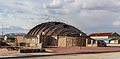
In Ollagüe and in the village of Buenaventura about 5 km away ( ), the sulfur extracted from the two volcanoes used to be loaded onto the railroad. Today, Ollagüe has only around 200 inhabitants, many of whom work for the border station or the railroad.

Main road

school

church

railway station
City Hall


Climate diagram for the Bolivian border station Estación Avaroa, 4 km from Ollagüe.
See also
Web links
Footnotes
- ↑ The location information in this article is largely based on Google Earth.