Orava reservoir
| Orava reservoir | |||||||
|---|---|---|---|---|---|---|---|
| Arwa reservoir | |||||||
|
|||||||
|
|
|||||||
| Coordinates | 49 ° 23 '59 " N , 19 ° 32' 44" E | ||||||
| Data on the structure | |||||||
| Construction time: | 1941-1953 and 1972-1988 | ||||||
| Height of the barrier structure : | 28 m | ||||||
| Power plant output: | 21.8 MW | ||||||
| Data on the reservoir | |||||||
| Water surface | 35.2 km² | ||||||
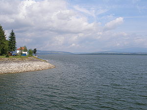
The Orava Reservoir ( Oravská priehrada in Slovak , Jezioro Orawskie in Polish ) is a reservoir in northern Slovakia . With 35.2 km² it is the largest body of water in the country. The reservoir was created to generate electricity between 1941 and 1953 by damming the two headwaters of the Orava ( Arwa in German ) by a dam , whereby some former villages ( Slanica , Osada , Oravské Hámre , Lavkovo and Ústie ) were flooded. The reservoir extends in the north right up to the border with Poland .
As a side effect, the reservoir developed from a secluded rural area to a holiday region with many hotels, guest houses and chatas (weekend houses) directly on the lake. A new place was even created, Ústie nad Priehradou , in the corridors of Oravské Hámre, Osada and Ústie.
From Slanica only the Kirchberg with the church standing on it looks out of the water. A permanent exhibition was set up in it as a branch of the Orava Gallery in Dolný Kubín . It is therefore called the Museum Island .
The town of Námestovo is located on the reservoir . The district Slanická Osada can be reached from there via a bridge over the lake . From there, hourly boat trips to the Museum Island in the lake can be taken in summer (15 May to 15 September). The price of the boat trip includes the entrance fee to the Museum Island.
When the water level is very low, the island can also be reached on foot from the north bank from Ranč u Edyho ( Eddy's Ranch ). In winter, the island is officially inaccessible and the museum there is closed, but the ice cover is usually thick enough from December to March to reach the island with ice skates or on foot. The ice condition is to be inquired locally.
The main lake described above with the 28 meter high and up to 14 meter thick dam wall (VD Orava) was expanded from 1972 to 1978 by a second dam wall (VD Tvrdošín) below the first one, located directly in the town of Tvrdošín . This created a second water basin, where the place Štefanov nad Oravou is located.
The reservoir and the associated dams are operated by the "Slovenský vodohospodársky podnik" (SVP). In the VD Orava, an output of up to 21.8 MW is achieved using two Kaplan turbines with 50 m³ / s each.

