Ordensburg Prussian mark
| Ordensburg Prussian mark | ||
|---|---|---|
|
Tower of the outer bailey (August 2006) |
||
| Castle type : | Niederungsburg | |
| Conservation status: | ruin | |
| Place: | Przezmark | |
| Geographical location | 53 ° 51 '33.1 " N , 19 ° 29' 43.2" E | |
|
|
||
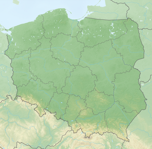
The Ordensburg Preußisch Mark was a castle of the Teutonic Order in Preußisch Mark (today Przezmark ), on the western border of the former East Prussia . The ruins of the castle with a preserved bailey tower are located on a peninsula of the Singer Lake between the Great (Motława Wielka) and the Small Motława Lake (Motława Mała).
history
It is documented around 1274 that there was a single-wing religious house. At the beginning of the 14th century there is evidence that a Schäffler Eckart was busy with stockpiling grain. From 1320 the castle was expanded and served as an outer bailey to the Marienburg .
After the Battle of Tannenberg , the castle was handed over to the victorious Poles. However, the notary who was supposed to deliver the inventory of the castle to King Jagiello was murdered at the instigation of Commander Mrocwko. Shortly afterwards, the castle was again owned by the order and designated as the house of the Christburg Commandery, as its previous seat had been destroyed. That is why the Preußisch Mark Castle was expanded to include a convent house.
During the Thirteen Years of City War , the castle was conquered by citizens from Elbing, captured by the order and then besieged by Polish troops.
After the decline of the Teutonic Order, the castle was owned by the Bishops of Pomesania from 1508 to 1527 . Due to the financial difficulties of the Duchy of Prussia , the castle was pledged several times.
From 1521 the castle was owned by the von Egmon and von Werdte families and was converted into a castle in the 1580s.
In the second Swedish-Polish War , the castle served again as a defensive structure from 1656 to 1660.
Building stock
The complex consisted of a main castle and two outer castles . The main house was a four-wing complex that was 73 m long and 47 m wide, the three-story east wing of which is the oldest part of the building. Foundations, granite pillars and vaulted ribs are still preserved from the east wing.
To the north of the main house was a first outer bailey, separated by a ditch . On the north side of the first outer bailey there was a large gate system, on the north-west corner a round tower , of which the foundations have been preserved. At the other end is the still standing corner tower of the first outer bailey, which contained dungeons , living cells and guard rooms and also served as a bell tower. A bridge, the pillars of which can still be seen, led to a second outer bailey, the “first bastion”, which was located on a hill. Today there is a church there.
Today, exhibitions and events take place in the preserved Vorburgturm.
Individual evidence
- ↑ a b Friedrich Borchert: Burgenland Prussia . Mahnert-Lueg near Langen-Müller, 1987, p. 150-154 .
- ^ Michael Antoni: Dehio manual of the art monuments West and East Prussia: the former provinces of West and East Prussia (Teutonic Order Prussia) with Bütower and Lauenburger Land . German art publisher, 1993.
- ↑ Zamki Polskie, PRZEZMARK. Retrieved May 27, 2019 .


