Osterberg (Rhenish Slate Mountains)
| Osterberg | ||
|---|---|---|
|
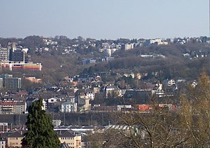
The Osterberg seen from the Nützenberg. The university hall is faintly visible in the forest at the beginning of April |
||
| height | 280 m | |
| location | Wuppertal | |
| Mountains | Rhenish Slate Mountains | |
| Coordinates | 51 ° 14 '26 " N , 7 ° 8' 57" E | |
|
|
||
|
The surveys in Wuppertal |
||
The Osterberg is a 280 meter high elevation in North Rhine-Westphalia, in the southern urban area of Wuppertal .
topography
The Osterberg, which has the shape of a terrain spur , is located between the Wuppertal districts of Elberfeld and Cronenberg in the Elberfeld district .
It lies east of the Friedrichsberg and is separated from it by the valley of the Hatzenbeck brook . In the east lies the valley of the Ostersiepen stream , which later flows into the Hatzenbeck at the foot of the Osterberg, separating it from the Grifflenberg . In the north, at the foot of the Grifflenberg, joins the Elberfelder Südstadt . In the south it goes over to the southern heights .
Buildings
The university hall , which opened in 1987, is located on the lower Osterberg , where it is largely forested. There are allotment gardens on the slopes . In the upper area, in the transition to the south heights, there are numerous residential buildings, such as the high-rise buildings in Johannistal.


