Ourinhos
| Ourinhos | ||
|---|---|---|
|
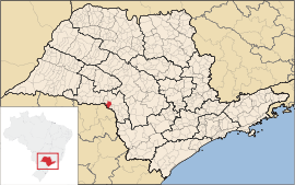
Coordinates: 22 ° 59 ′ S , 49 ° 52 ′ W Ourinhos on the map of Sao Paulo
|
||
| Basic data | ||
| Country | Brazil | |
| State | São Paulo | |
| City foundation | December 13, 1918 | |
| Residents | 112,711 (2018 estimate) | |
| City insignia | ||
| Detailed data | ||
| surface | 296.203 km 2 | |
| Population density | 381 inhabitants / km 2 | |
| height | 483 m | |
| Time zone | UTC −3 | |
| Website | ||
| Location of the municipality of Ourinhos in the state of São Paulo | ||
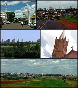
| City center in Ourinhos | ||
Ourinhos is a município in the state of São Paulo in Brazil , founded on December 13, 1918. It has 112,711 inhabitants (2018 estimate), who live on an area of 296.89 km², and is located at an altitude of 483 m.
The city lies at 22 ° 59 ' S , 49 ° 52' W .
Ourinhos has an airport with a 1500 m long asphalt runway ( IATA airport code OUS; ICAO code SDOU).
Diocese of Ourinhos
Personalities
- José Aparecido Gonçalves de Almeida (* 1960), auxiliary bishop in Brasília
- Wellington Luís de Sousa (* 1988), football player
Web links
- Official Website (Portuguese)


