Oursi
| Oursi | ||
|---|---|---|
| Status: | ( French d épartement ) ( French commune rurale ) |
|
| Region: | Sahel | |
| Province: | Oudalan | |
| Surface: | 1080 km² | |
| Residents: | 16.093 | |
| Population density: | 14.90 inhabitants / km² | |
| Structure: | 22 villages | |
| Mayor: | Mohamed Ag Rali | |
| Prefect: | Kayaba Korsaga | |
| location | ||
|
|
||

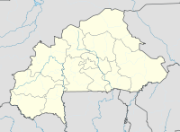
Oursi is a department and a municipality ( French commune rurale ) in the north of the West African state of Burkina Faso in the Sahel region and the province of Oudalan . It borders on Tin-Akoff to the north, Gorom-Gorom to the east and southeast, and Déou to the west .
Oursi is located in the Sahel and is subject to a tropical and humid climate with a rainy and a dry season. In the Oursi area there are old dunes of the Liptako-Oudalan complex, some of which have been reactivated by intensive use, and the Mare d'Oursi , a temporary lake important for cattle and migratory birds. The entire Oursis area is part of the Réserve sylvo-pastorale et partial de faune du Sahel nature reserve .
In addition, archaeological excavations have uncovered prehistoric settlements, including an approximately 1000-year-old mansion and artefacts, including ceramic pots and jewelry. Walls made of burnt clay bricks up to 150 cm high have been preserved.
Due to the uncertain situation in the north of Mali, Oursi will host the famous Festival au Désert between February 20 and 22, 2013 .
Oursi is divided into 22 villages ( French villages administratifs ); the following population figures for the villages do not correspond to the preliminary results of the 2006 census, which have not yet been published in detail:
| Village | Residents |
|---|---|
| Kollel | 1301 |
| Boullel | 1277 |
| Oursi 2 | 1248 |
| Yomboli | 1103 |
| Hondotchiré | 1038 |
| Soukoundou | 933 |
| Totori | 669 |
| Tringuel | 603 |
| Dialafanka | 579 |
| Timbolo | 479 |
| Gountouré | 473 |
| Tinatane | 432 |
| Oursi 1 | 427 |
| Petelgaoudi | 389 |
| Tin ediar | 314 |
| Tayaret | 285 |
| Gonadaouri | 255 |
| Tounté | 204 |
| Gaoudi | 6th |
| Bangounadji | - |
| Débéré | - |
| Torom | - |
Web links
- Archaeological excavations at the University of Frankfurt / Main in Oursi
- Article about the excavations at LeFaso.net (French)
Individual evidence
- ↑ INSD statistics collection for the Sahel region (PDF; 459 kB)
- ↑ Preliminary results of the 2006 census (PDF; 3.3 MB)
- ↑ a b Administrative structure of the province of Oudalan ( page no longer available , search in web archives ) Info: The link was automatically marked as defective. Please check the link according to the instructions and then remove this notice.
- ↑ Local election results ( Memento of the original from September 28, 2007 in the Internet Archive ) Info: The archive link was inserted automatically and has not yet been checked. Please check the original and archive link according to the instructions and then remove this notice.
- ↑ Council of Ministers, July 26, 2006 ( Memento of the original from October 6, 2007 in the Internet Archive ) Info: The archive link was automatically inserted and not yet checked. Please check the original and archive link according to the instructions and then remove this notice.
Coordinates: 14 ° 41 ′ N , 0 ° 28 ′ W

