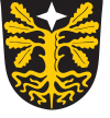
Paistu
| Paistu | |||
|
|||
| State : |
|
||
| Circle : |
|
||
| Coordinates : | 58 ° 16 ' N , 25 ° 37' E | ||
| Area : | 312.4 km² | ||
| Residents : | 1,601 (2010) | ||
| Population density : | 5 inhabitants per km² | ||
| Time zone : | EET (UTC + 2) | ||
| Telephone code : | (+372) 129 | ||
| Website : | |||

|
|||
Paistu ( German Paistel ) is a rural community in the Estonian district of Viljandi with an area of 129 km². It has 1601 inhabitants (as of 2009). Paistu is 13 km from Viljandi .
In addition to the main town Paistu, the rural community includes the villages Aidu (German: Aidenhof), Hendrikumõisa, Holstre (German: Holstfershof), Intsu, Kassi, Lolu, Loodi (German: Kersel), Luiga, Mustapali, Paistu, Pirmastu, Pulleritsu, Sultsi, Tömbi and Viisuküla.
Paistu was first mentioned in a document in 1234. Almost the entire population fell victim to the outbreak of the plague in 1710 . It was not until the middle of the 19th century that agriculture began to recover, with more effective agriculture.
Today a large part of the municipal area belongs to the Loodi Nature Park. The untouched forests and lakes are interesting for hiking tourists in summer and for cross-country skiers in winter .
Partner communities
Paistu is partnered with the Lower Saxony community of Bippen .
Sons and daughters of the village
- Ernst Reinhold Hofmann (1801–1871), Baltic German geologist, geographer, mineralogist and explorer
Individual evidence
- ↑ Entry on the partnerships of the communities in the joint community of Fürstenau on their homepage.Accessed on May 7, 2019, 3:24 pm
Web links
- Website of the municipality of Paistu (Estonian)
- Parish of Paistel in the Fellin district

