Parc national de Frontenac
|
Parc national de Frontenac
|
||
|
View of the Baie Sauvage |
||
| location | Les Appalaches , Le Granit in Québec (Canada) | |
| surface | 155.3 km² | |
| WDPA ID | 66604 | |
| Geographical location | 45 ° 52 ′ N , 71 ° 13 ′ W | |
|
|
||
| Setup date | 6.8.1987 | |
| administration | Parcs Québec | |
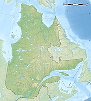
The Parc national de Frontenac is a 155.3 km² provincial park in the southeast of the Canadian province of Québec . In Québec, however , a parc national corresponds to what a provincial park is in the other provinces and territories .
It was established in 1987 and is operated by Sépaq ( French Société des établissements de plein air du Québec or English Society of outdoor recreation establishments of Quebec ). The reserve is located along the Grand lac Saint-François , halfway between the two cities of Québec and Sherbrooke . The closest town is Thetford Mines .
The park includes the rolling hills of Estrie , Beauce and Bellechasse . More than 153 species of birds and more than 30 mammals can be seen in the park.
The park is divided into 3 sectors: Saint-Daniel , Sud and Sainte-Praxède .
In the Saint-Daniel sector in the north of the park there is a raised bog area .
See also
Web links
Individual evidence
- ↑ Existing Park - Ministère du Développement durable, de l'Environnement et des Parcs, accessed on September 19, 2007
- ↑ - Registre des aires protégées au Québec (PDF; 37 kB) - Ministère du Développement durable, de l'Environnement et des Parcs du Québec, accessed on September 19, 2007
- ↑ SEPAQ - Parc national de Frontenac

