Parc national de la Gaspésie
|
Parc national de la Gaspésie
|
||
|
Lac aux Américains |
||
| location | La Haute-Gaspésie , La Matanie in Québec (Canada) | |
| surface | 802 km² | |
| WDPA ID | 23125 | |
| Geographical location | 48 ° 56 ' N , 66 ° 14' W | |
|
|
||
| Setup date | 11/25/1981 | |
| administration | Parcs Québec | |
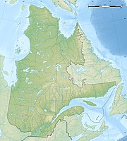
The Parc national de la Gaspésie is a provincial park in the southeast of the Canadian province of Québec . It is one of currently 27 national parks in the province. There a parc national corresponds to what is called a provincial park in the other provinces . The park is operated by Sépaq ( French Société des établissements de plein air du Québec or English Society of outdoor recreation establishments of Quebec ).
It is located south of the town of Sainte-Anne-des-Monts in the interior of the Gaspésie Peninsula . The park was established on November 25, 1981 and covers an area of 802 km².
The highest located in Quebec mountain in the Appalachian Mountains , the Mont Jacques-Cartier , located in the reserve. The park is home to the only Canadian forest caribou herd south of the Saint Lawrence River .
See also
Web links
Individual evidence
- ↑ Existing Park - Ministère du Développement durable, de l'Environnement et des Parcs, accessed on September 19, 2007
- ↑ - Registre des aires protégées au Québec (PDF; 37 kB) - Ministère du Développement durable, de l'Environnement et des Parcs du Québec, accessed on September 19, 2007


