Parc national des Pingualuit
|
Parc national des Pingualuit
|
||
|
Pingualuit crater |
||
| location | North du Québec in Québec (Canada) | |
| surface | 1133.9 km² | |
| WDPA ID | 308509 | |
| Geographical location | 61 ° 18 ′ N , 73 ° 40 ′ W | |
|
|
||
| Setup date | February 16, 2004 | |
| administration | Parcs Nunavik | |
The Parc national des Pingualuit ( Inuktitut ᐱᖑᐊᓗᐃᑦ ) is a 1133.90 km² provincial park . Although the reserve is called Parc national , it corresponds to what is called a Provincial Park in the other provinces and territories .
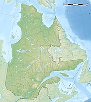
The park, which was established on February 16, 2013, is located on the Ungava Peninsula in the far north of the Canadian province of Québec in the Nunavik region . The closest place, the Inuit settlement Kangiqsujuaq , is about 100 km northeast of the park.
The park is located in the tundra plateau of the Ungava peninsula. The main attraction of the park is the Pingualuit Crater , a relatively young impact crater .
In principle, the Parcs national in the province of Québec are administered by the Société des établissements de plein air du Québec (Sépaq). However, since the park is north of the 55th parallel and therefore in the Nunavik region, it is managed by Parcs Nunavik, which is subordinate to the Administration régionale Kativik (Kativik Regional Government, KGR) .
See also
Web links
Individual evidence
- ^ Parc national Pingualuit. Commission de toponymie de Québec, accessed July 3, 2020 (French).

