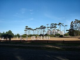
Parque Carrasco
| Parque Carrasco | ||
|---|---|---|
|
Coordinates: 34 ° 51 ′ S , 56 ° 0 ′ W Parque Carrasco on the map of Uruguay
|
||
| Basic data | ||
| Country | Uruguay | |
| Department | Canelones | |
| Residents | 8628 (2011) | |
| Detailed data | ||
| Post Code | 15000 | |
| Location of Parque Carrasco in the Ciudad de la Costa | ||
| Plan of Parque Carrasco | ||
| Centro Hípico in Parque Carrasco | ||
Parque Carrasco is a city in Uruguay .
Geography and transport infrastructure
The coastal city is located in the southern part of the Canelones department in sector 37 . It borders with its southeast side on the Río de la Plata . Shangrilá is directly connected to the coastline, which continues to the northeast , while Barra de Carrasco in the southwest and Paso de Carrasco in the northwest share a city boundary with Parque Carrasco. Parque Carrasco is located on the south side of Ruta 101 . North of this street extends the area of the airport of Montevideo and the place of the same name Aeropuerto Internacional de Carrasco , in which 251 inhabitants are registered.
history
The formerly independent city has been part of this city union since the founding of the Ciudad de la Costa in 1994.
Residents
The population of Parque Carrasco is 8,628 (as of 2011).
| year | Residents |
|---|---|
| 1963 | 922 |
| 1975 | 3,914 |
| 1985 | 5,658 |
| 1996 | 8,169 |
| 2004 | 8,476 |
| 2011 | 8,628 |
Source: Instituto Nacional de Estadística de Uruguay
Web links
- City map of Parque Carrasco (PDF; 188 kB)
Individual evidence
- ^ Códigos Postales del Interior
- ↑ a b Statistical data of the Instituto Nacional de Estadística de Uruguay - status 2004 ( MS Excel ; 75 kB), accessed on October 24, 2010
- ↑ City map of Aeropuerto Internacional de Carrasco (PDF; 143 kB)
- ↑ Statistical data from the Instituto Nacional de Estadística de Uruguay , accessed on July 4, 2013
- ↑ Statistical data of the Instituto Nacional de Estadística de Uruguay 1963–1996 (DOC; 148 kB)


