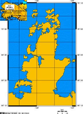
Parry Peninsula
| Parry Peninsula | ||
 Parry Peninsula, Canada with embedded map of Alaska |
||
| Geographical location | ||
|
|
||
| Coordinates | 69 ° 40 ′ 0 ″ N , 124 ° 40 ′ 0 ″ W | |
| Waters 1 | Franklin Bay , Amundsen Gulf | |
| Waters 2 | Darnley Bay | |
The Parry Peninsula is part of Canada's Northwest Territories . It lies on its north coast in the Arctic Ocean , bordered to the west by Franklin Bay , to the north by the Amundsen Gulf and to the east by Darnley Bay . The closest settlement is Paulatuk .
Its name goes back to the polar explorer William Edward Parry . It is home to a Canadian migratory bird sanctuary.
