Paunell
| Paunell | ||
|
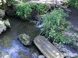
The Paubach flows into the Hangeweiher |
||
| Data | ||
| location | Germany ; North Rhine-Westphalia | |
| River system | Rhine | |
| Drain over | Pau → Wurm → Rur → Maas → Hollands Diep → North Sea | |
| River basin district | Meuse
|
|
|
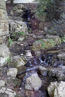
Artificial waterfall of the Paubach just before the slope pond |
||
The Paunell (little Pau, also called Paunelle , Pounell or Ponnell ) is one of the Aachen streams that flow through the old town of Aachen . It belongs to the Wurm brook system , which drains the Aachen valley basin.
origin
Most city historians assume that the water of the Paunell is that part of the water of the Paubach, which rises in the Aachen city forest on the Ronheider Berg, which was not diverted into artificial canals as a Pau for the water and energy supply of the medieval city. It is therefore assumed that the course of the Paunell corresponds to the original course of the Pau before its canalization. Individual authors, however, assume that Pau and Paunell were originally independent streams.
history
In 1242 a "mill on the Ponnell" is mentioned in a document, which was outside the city and was later called Schleifmühle (on today's Goethestrasse). This is the oldest mention of the name "Ponnell". The name was first mentioned in a document in 1344 within the city. Before that, however, a "rivulus" (small stream) flowing through the city was already mentioned, which is most likely identical to the Paunell, since it was the only stream next to Pau and Johannisbach that flowed through the medieval city area.
In contrast to Pau and Johannisbach, the Paunell did not flow through the inner city, which was surrounded by the inner wall . For this reason, and because of the smaller amount of water and the smaller gradient within the outer wall, its importance for the medieval city was less than that of the other two streams. But there were also three mills on it, the grinding mill on Goethestrasse, the powder mill on Mozartstrasse between Beethovenstrasse and Boxgraben, and the copper mill on Karmeliterstrasse.
During the siege of Aachen in 1248 , when the outer city wall had not yet begun, Wilhelm von Holland had Johannisbach, Pau and Paunell dammed and thereby flooded a large part of the city area to force Aachen to give up.
Historical course
After the branching of the water for the Pau Paunell in medieval times flowed on to Hangeweiher and from there approximately along Goethe and Mozartstrasse the outer walls . There she entered the medieval city under the Great Pounell Tower . The course continued along Karmeliterstraße (formerly called Pounellengasse) and part of Franzstraße. Then she turned and ran parallel to the inner wall behind the theater to Wirichsbongardstrasse, where she was crossed by the Pau, and on to Adalbertstrasse. There she took up the water that was led by the Pau through the moat. At the location of Willy-Brandt-Platz, where the Pletschmühle operated by the Amya family and others stood in the Middle Ages and where the Kugelbrunnen stands today, it merged with the Johannisbach , a little further towards Kaiserplatz with the Pau. North of Kaiserplatz, the three combined brooks left the medieval city through the water tower and shortly afterwards flowed into the Wurm.
Today's course
Today the Paunell runs from the slope pond together with the Pau underground through the city. The common canal roughly follows the historical course of Paunell to Franzstrasse, but then runs all the way down Franzstrasse and runs along Kapuzinergraben and Friedrich-Wilhelm-Platz to Peterstrasse. Pau / Paunell merge with the Johannisbach under Peterstraße, only to flow into the Wurm shortly afterwards. The worm reappears at Europaplatz.
literature
- Carl Rhoen : The older topography of Aachen . Verlag der Cremersche Buchhandlung, Aachen 1891. (Online version, pdf part 1, 2.84 MB , part 2 with map, 2.61 MB )
- Walter Holtzhausen, Jochen Richard a. a .: Südstraße and the Reumont district . 7th edition. Aachen 2007. ( Online version, pdf 2.84 MB )
- Christof Peter, Franz Meiers, Gabi Heidner, Gabi Hermsdorf, Hartmut Welters, Henry Beierlorzer and Rita Caesar, Spurensicherung - Walks along the Aachen brooks, February 1983, page 69 ff. ("The Paunelle"), library of the Burtscheid Society for History and Present .
Web links
- Bach disclosures in Aachen
- The Johannisbach. In: The Aachen brooks. Ecology Center Aachen eV, accessed on May 10, 2018 (with map showing the historical and current course of the Paunell).


