Penemu
| Penemu | ||
|---|---|---|
| Penemu | ||
| Waters | Halmahera Lake | |
| Archipelago | Faminseln / Raja Ampat | |
| Geographical location | 0 ° 35 ′ S , 130 ° 16 ′ E | |
|
|
||
| The Faminseln are located in the northwest of Raja Ampat | ||
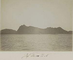
Penemu ( Groß-Fam , Fam Besar ) is an island in the Halmahera Sea . It belongs to the Faminseln , within the Raja Ampat archipelago, off the coast of New Guinea . Penemu is uninhabited.
geography
Penemu is the northernmost of the Faminseln, in the northwest of Raja Ampat. To the south lies the main island of Fam . There are several small rock islands just off the coast of Penemu, including Keroeo . The steep cliffs and narrow bays on the east coast are striking, with some very hidden entrances. There are sandy beaches between the rocks.
Penemu is part of the West Waigeo Islands District ( Waigeo Barat Kepulauan ) in the Raja Ampat Administrative Region ( West Papua Province ).
Individual evidence
- ^ A b Papua Travel Information: Fam & Penemu: Fishing Villages & Rock Islands , accessed March 27, 2015.
- ^ Map of Raja Ampat , accessed May 26, 2015.
- ^ Map of the region , accessed on April 24, 2015.


