Petenwell Lake
| Petenwell Lake Petenwell Dam |
|||||||||
|---|---|---|---|---|---|---|---|---|---|
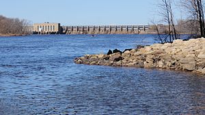
| Petenwell Dam and power station below the reservoir | |||||||||
|
|||||||||
|
|
|||||||||
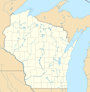
| Coordinates | 44 ° 8 ′ 6 ″ N , 89 ° 58 ′ 16 ″ W | ||||||||
| Data on the structure | |||||||||
| Construction time: | 1948 | ||||||||
| Power plant output: | 20 MW | ||||||||
| Operator: | Wisconsin River Power Company, Wisconsin Public Service |
||||||||
| Data on the reservoir | |||||||||
| Altitude (at congestion destination ) | 272 m | ||||||||
| Water surface | 93.8 km² | ||||||||
| Reservoir length | 21.8 km | ||||||||
| Reservoir width | 5.4 km | ||||||||
| Maximum depth | 13.4 m | ||||||||
The petenwell lake is a reservoir on the Wisconsin River in the US state of Wisconsin .
Petenwell Lake is dammed by the Petenwell Dam ( ⊙ ). This was built in 1948 by the Wisconsin River Power Company (WRPC) for the purpose of power generation and flood protection. The 21.8 km long Petenwell Lake covers an area of 93.8 km². The maximum water depth is 13.4 m. The reservoir is located on Wisconsin's Central Plain , where the prehistoric ice reservoir Glacial Lake Wisconsin extended. The hydropower plant has an installed capacity of 20 MW. It is jointly operated by Wisconsin River Power Company (WRPC) and Wisconsin Public Service (WPS).
Castle Rock Lake joins the river downstream .
Flora Fauna
The riverside landscape consists mostly of forest , where bald eagles live. In the reservoir u. a. The following fish species are found: pike , muscle lung , eyeglasses , largemouth bass , black bass and sturgeon .
Web links
Individual evidence
- ↑ a b c Petenwell . Wisconsin River Power Company (WRPC). Retrieved December 8, 2017.
- ↑ a b c Petenwell Lake . Wisconsin Dept. of Natural Resources. Retrieved December 8, 2017.
- ^ Hydroelectric power plants . Wisconsin Public Service (WPS). Retrieved December 8, 2017.

