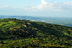
Pico do Papagaio (Pernambuco)
| Pico do Papagaio | ||
|---|---|---|
| height | 1260 m | |
| location | Pernambuco , Brazil | |
| Coordinates | 7 ° 49 ′ 13 ″ S , 38 ° 3 ′ 22 ″ W | |
|
|
||
The Pico do Papagaio is the highest point in the Brazilian state of Pernambuco . The mountain reaches a height of 1260 m , according to some sources 1185 m.
geography
The mountain lies on the northern border with the state of Paraíba between the places São José de Princesa (Paraíba) and Triunfo and Flores (Pernambuco) . The western slope already belongs to the neighboring state to the northwest. The summit is not a single summit, but rather a hill formation. Well-developed hiking trails lead to the highest point, where a small copy of the Cristo Redentor is set up on a large monolith , as well as another statue of an indigenous peoples with a snake nearby .
Individual evidence
- ^ Ecotourism . Pernambuco Tourism Secretary. Retrieved February 15, 2010.
Web links
- Pico do Papagaio (Pernambuco) on Peakbagger.com (English)
- tripadvisor.com.br
- oreversodomundo.com
- vivaosertao.com.br

