
Pinios (Peloponnese)
|
Pinios Πηνειός, Peneus |
||
.jpg) Course of the Pinios |
||
| Data | ||
| location | West Greece ( Greece ) | |
| River system | Pinios | |
| source | at the foot of the Erymanthos | |
| muzzle | at Gastouni in the Ionian Sea Coordinates: 37 ° 48 ′ 19 ″ N , 21 ° 14 ′ 12 ″ E 37 ° 48 ′ 19 ″ N , 21 ° 14 ′ 12 ″ E |
|
| Mouth height |
0 m
|
|
| length | approx. 70 km | |
| Reservoirs flowed through | Pinios dam | |
 |
||
The Pinios ( Greek Πηνειός ) is an approximately 70 kilometer long river in the northwest of the peninsula Peloponnese .
The river has its source on the south side of Mount Erymanthos and flows from there in a westerly direction through the south of the plain of Elis until it flows into the Ionian Sea at Gastouni .
Since the 1960s there has been massive interference in the course of the river. The construction of a two-kilometer-long dam at Kendro (Κέντρο, 37 ° 53 ′ 43 ″ N , 21 ° 26 ′ 53 ″ E ) is particularly noteworthy . This created the Pinios Dam (Τεχνητή Λίμνη Πηνειού), eight kilometers long and up to seven kilometers wide, with an area of 19.895 km².
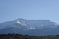
Erymanthos

View from the dam after a hot summer

Dried out reservoir floor


