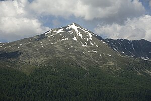
Piz Dora
| Piz Dora | ||
|---|---|---|
|
Piz Dora seen from the northeast ( Lü ) |
||
| height | 2951 m above sea level M. | |
| location | Canton of Graubünden , Switzerland | |
| Mountains | Alps (Eastern Alps) | |
| Dominance | 1.9 km → Piz Daint | |
| Notch height | 270 m ↓ Taunter Pizza | |
| Coordinates | 819 655 / 165535 | |
|
|
||
The Piz Dora is a mountain between Val Müstair (Münstertal) and Val Mora in the Swiss canton of Graubünden .
Location and name
The Piz Dora belongs to the Piz-Daint - Piz-Turettas -Stock, which separates the two valleys, and in its intermediate position as an isolated massif between the Sesvenna group in the north (to the Lower Engadine), Livigno Alps in the southwest (between the Upper Engadine and Adda) and the Ortler massif in the southeast, for example, is systematically included in the Ortler Alps . There are also other classifications, here in the Swiss-Italian-South Tyrolean border area different systematics are used.
Originally, the mountain was called Piz d'Ora , Romansh for 'outer summit', in relation to the neighboring Piz Daint to the west, originally Piz d'Aint , 'inner summit', in the valley directly above the Ofenpass . In the late 20th century the spelling was changed to Piz Dora .
literature
- National map of Switzerland 1: 25000, sheet 1239, Sta Maria
Web links
Individual evidence
- ^ Alpine association division of the Eastern Alps (AVE) so that the Umbrailstock belongs to the Ortler area.

